Mountain bike route "Around the Habichtspiel"


- 3:00 h
- 15.68 km
- 425 m
- 270 m
- 359 m
- 598 m
- 239 m
- Start: The starting point is the MTB parking lot "Roter Stollen", alternatively, you can also begin from the hiking parking lot "Firnsbachtal".
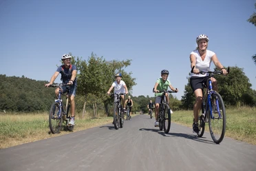
You can start the approximately 16 km long route from two different starting points. The route includes both asphalted and unpaved paths with various inclines and descents. The circular course will automatically lead you back to your starting point.
This MTB circular route was established by the Zweckverband Naturpark Habichtswald in cooperation with Hessen-Forst. The route passes through state forests in the southern Habichtswald and, outside the forest, through the territory of the municipality of Schauenburg.
Good to know
Pavements
- Unknown (100%)
Best to visit
- suitableDepends on weather
Tour information
Loop Road
Loop Road
Author
Naturpark Habichtswald
Organization
License (master data)
Naturpark Habichtswald

Social Media
Nearby

Download GPX file