- 1:17 h
- 3.98 km
- 159 m
- 111 m
- 128 m
- 276 m
- 148 m
- Start: Horst`s Höhe (western part)
- Destination: Horst`s Höhe (western part)
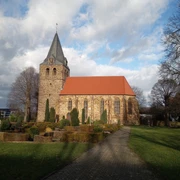
Natural idyll on the Wiehengebirge
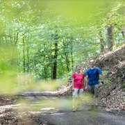
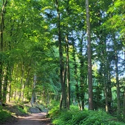
The East Westphalian town of Lübbecke is picturesquely situated on the northern slope of the Wiehengebirge and delights visitors with its impressive natural scenery. As part of the Minden-Lübbecke district, Lübbecke offers a unique transition from the low mountain range to the North German lowlands - ideal for long hikes and relaxing walks.The varied coniferous and deciduous forests are particularly beautiful in spring and autumn. Here you can discover rare wild plants, observe wild animals and capture breathtaking photo opportunities.
The Wiehengebirge has been part of the "Northern Teutoburg Forest / Wiehengebirge" TERRA.vita Nature Park since 1962. UNESCO awarded the mountain range the title of "Unesco Global Geopark" in 2015 - a sign of the outstanding geological and scenic importance of this region.
Tip: Make a detour to Barre's Brauwelt and discover the art of brewing beer in Lübbecke!
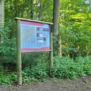
Good to know
Best to visit
suitable
Depends on weather
Tour information
Loop Road
Directions & Parking facilities
Horst`s Höhe (western part)
How to get off to a good start
- Autobahn A 2 Ruhrgebiet - Hanover - BerlinExit Herford/Lübbecke (30 km), exit Bad Eilsen (40 km)
- Autobahn A 30 Netherlands - Osnabrück - Bad Oeynhausen exit Kirchlengern/Lübbecke (15 km)
- Bundesstraße B 65 Hanover - Minden - Lübbecke - Osnabrück
- Bundesstraße B 239 Diepholz - Lübbecke - Höxter
Author
Anna-Lena Rose
Organization
Lübbecke Marketing e.V.
License (master data)

Safety guidelines
Hiking trails may be impaired due to forestry work.
Nearby