- Photos & Map
How would you like to arrive?
- Description
- Good to know
- Nearby
Download GPX file
- 4:24 h
- 41.54 km
- 1,100 m
- 1,100 m
- 157 m
- 462 m
- 305 m
- Start: ADFC Station Bad Meinberg, Brunnenstraße 67 32805 Horn - Bad Meinberg
- Destination: ADFC Station Bad Meinberg, Brunnenstraße 67 32805 Horn - Bad Meinberg
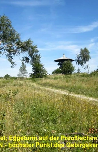
We take you from the starting point at the ADFC station in Bad Meinberg through the mountainous eastern foothills of the Teutoburg Forest / Eggegebirge. From the Napte valley you climb 160 m up to the Bellenberg and charge through the woods into the valley of the Heubach. Pass Vinsebeck Castle and climb up to the next panoramic ridge above Sandebeck. After a detour to the "Vulkan Embrio" volcano, we climb the ridge of the Eggegebirge on a steep natural road, briefly descending to the NATO road on the west side and then back up to the striking observation tower on the "Preussische Velmerstot" - 468 m/nn - the highest point of the Eggegebirge.
The special thing about this mountain: from 1950 to 1995, the mountain head was home to a bunkered NATO anti-aircraft missile station. The area was renaturalized as part of the NSG project, and rare pioneer plants have since conquered this extreme location. Today, the observation tower offers a magnificent view of up to 100 km.
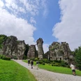
The route then leads steeply down into the upper Silberbach valley and through wide, secluded forests to the Egge Bundesstraße 1 pass. On wild forest paths, we cycle past the Barnacken - the highest point of the Teutoburg Forest - to the Kleiner Rigi pass with its hidden ground monument "Roman Path Traces". We then cycle steeply downhill on a wild track for 150 m to the Externsteine natural and cultural monument.
The Felsenwirt and the information center invite you to visit, then we roll through the historic old town of Horn and on a meadow trail past the moor extraction plant back to the starting point.
Good to know
Best to visit
Directions
The following villages are located along the route:
Bad Meinberg - Vahlhausen - Bellenberg - Vinsebeck - airfield - Sandebeck - Vulkan-Embrio - Feldrömer Pass - NATO road - Preußische Velmerstot with Eggeturm - Feldrom - Veldrom - Egge-Pass / Bundesstraße 1 - Barnacken - Kleiner Rigi - Externsteine - Horn - Moorstich - Bad Meinberg.
The route description is provided via GPS track in the download area.
Alternatively, the ADOBE PDF map printout is available for download from this system.
The ADFC recommends the "BVA Radwanderkarte im Kreis Lippe 1:50,000 - ISBN 978-3-87073-628-6" for local orientation.
Tour information
Loop Road
Stop at an Inn
Equipment
A spare inner tube and an air pump should not be missing in the lonely wide forests of the Teuto region.
A full drinks bottle is recommended.
Directions & Parking facilities
The free parking lot is located at the junction of "Brunnenstraße / Hamelner Straße", from there it is approx. 350 m to the starting point in the traffic-calmed center of Bad Meinberg.
From there, continue by bus to the public transport stop:
Horn - Bad Meinberg, Bad Meinberg bus station.
From there, the ADFC bike station is signposted with the "Bike-Rent" sign.
Always know what's running: The smart number for buses and trains in NRW 0800 6-50 40 30 (free of charge and available around the clock).
Additional information
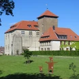
Schloß Vinsebeck, small private baroque castle with park - not open to the public
.Vinsebeck airfield, sport aviation on the Frankenberg.
Volcano-Embrio Sandebeck, northernmost volcano in Germany.
Eggeturm from the Prussian Velmerstot.
Barnacken with the Roman traces at the small Rigi, historic pass crossing in the heart of the Teutoburg Forest.
Externsteine, important natural and cultural monument.
Moorstich Bad Meinberg, natural moor with health benefits to experience.
Literature
Author
Manfred Wiehenkamp
Organization
Teutoburger Wald Tourismus
License (master data)
Author´s Tip / Recommendation of the author
- Vinsebeck airfield, on request and if you are lucky, you may be able to fly with us. Volcano-Embrio Sandebeck, geological feature in the Teutoburg Forest Nature Park.
- Eggeturm, particularly worthwhile on a "clear day".
- Externsteine, tourist attraction in the Teutoburg Forest with cultural history.
Safety guidelines
- The forest paths in the Teutoburg Forest are generally very easy to cycle on .
- The "HERMANNSHÖHEN" hiking trail in the Feldrömer Pass - Preußische Velmerstot section is not passable for MTB cyclists .
- Seasonal weather events or forest maintenance work can lead to damage / obstructions / trail closures .
- The NRW State Forestry Act must be observed. This has been observed in the route guidance.
- The author accepts no liability for the accuracy of the tourist information / links and the GPX track. Mobile network reception is limited or not possible in parts of the Teutoburg Forest, please note this when using non-outdoor GPS devices.
Map
Nearby
