- 3:00 h
- 8.90 km
- 273 m
- 273 m
- 357 m
- 597 m
- 240 m
- Start: Park an der Kyll (Kurpark)
- Destination: Park an der Kyll (Kurpark)
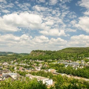
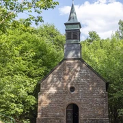
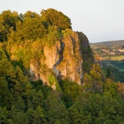
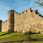
While the uphill climb to the Heiligenstein may cost a great deal of effort on this seven kilometre-long circular route, the reward is the wonderful view over the summits of the Eifel. The Kasselburg castle can be seen from here, as can a part of the town of Gerolstein and the rock formation in Munterley. Just a short while later, you need to be sure-footed, with steep steps leading up to the “Dietzenley” viewing tower. You are greeted with a surprising sight in the middle of the Gerolsteiner Wald forest in the form of the “Büschkappelle”, or “bush chapel”, a small church of St. Mary and a pilgrimage destination. The route can be covered in two to three hours, leaving enough time for visiting other places of interest in and around Gerolstein, such as the natural history, telephone and local history museum in Gerolstein or the ruins of the Löwenburg castle.
Good to know
Best to visit
Author
Eifel Tourismus GmbH
License (master data)
Eifel Tourismus GmbH

Nearby