- Photos & Map
How would you like to arrive?
- Description
- Waypoints
- Good to know
- Nearby
- 6:00 h
- 20.35 km
- 359 m
- 235 m
- 45 m
- 181 m
- 136 m
- Start: Hörstel station
- Destination: Tecklenburg, market square
1. Start and finish point of the stage
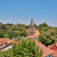
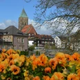
The stage begins in Hörstel on the western edge of the Teutoburg Forest and ends in Tecklenburg, Germany's northernmost mountain town, which is characterized by small alleys with lots of half-timbered houses.
2. Length of the stage in kilometers / altitude difference / route character
The stage is 20 kilometers long and has an altitude difference of around 300 meters. The trail is varied and leads through quiet sections of forest, over steep rock faces and along the "Dörenther Klippen" sandstone formations.
3. Scenic features
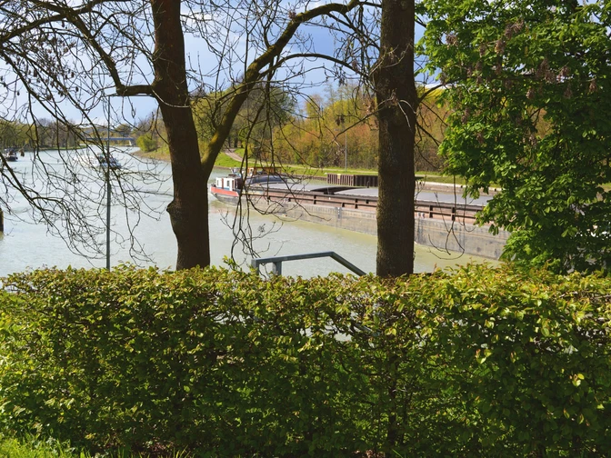
The stage leads for long stretches through the Teutoburg Forest and offers spectacular views of the "Wet Triangle", the confluence of the Ems and Mittelland Canal, and the vast lowlands of the Münsterland. Sandstone is an integral part of the route and is particularly impressive in the sections up to Brochterbeck, where there are also some steep rock faces. From the picturesque village of Brochterbeck, the route crosses an old cultural landscape, whose silent witnesses in the form of old farmland, hedgerows and dry stone walls can be found along the way. On the parallel Witches' Trail, you may even encounter one of the mystical creatures from the town's eventful history.
Tip: The steep rock faces up to Brochterbeck also offer climbing courses for particularly sporty hikers.
Highlights on the routeThe viewing platform "Schöne Aussicht" is a popular attraction in Hörstel, offering spectacular views of the surrounding area. The audio station by Anna & Hermann tells a touching story about the creation of the viewing platform and invites you to find out more about the region.The Dörenther Klippen near Ibbenbüren are a unique geological phenomenon and are characterized by their bizarre sandstone formations. They are a striking rock formation created by erosion and the effects of weathering. The Hockende Weib is particularly well-known.The viewing platform at the Almhütte offers a breathtaking panoramic view of the Münsterland region. You can take a relaxing break here and enjoy nature.The romantic timbered town of Tecklenburg is a popular excursion destination and attracts visitors with its lovingly renovated half-timbered houses and the largest open-air stage in Germany.
Waypoints
Good to know
Pavements
Best to visit
Directions
If you want to end your hike early in Ibbenbüren, please take the designated Access path down to the town.
You will find the following quality Hermannshöhen establishments on this stage:
- Hörstel OT Riesenbeck: Hotel Riesenbeck, tel. 05454-3969895, www.hotel-riesenbeck.de
- Tecklenburg-Brochterbeck: Ringhotel Teutoburger Wald, Tel: 05455 93000, www.ringhotel-teutoburger-wald.de
Tour information
Cultural Interesting
Familiy-Friendly
Good Connection to public Transport
Premium Trail "Wanderbares Deutschland"
Stop at an Inn
Tour with Dog
Equipment
Directions & Parking facilities
Parking lot at Huckberg
Huckbergstraße 16, 48477 Hörstel
Bus stop Abzweig Elseckweg
Rufbus T60 Hörstel - BevergernTel 0251-14480444 Register. 30 min. before departure
Wanderparkplatz am Nassen Dreieck
Am Steinbruch 61A, 48477 Hörstel (300m before)
directly on the way
Bus stop not available!Parking spaces with public transport connection along the path:
Parking space at Teutohang
Am Teutohang 110, 48477 Hörstel
approx. 150 meters to the pathBus stop Riesenbeck, Mitte
Rufbus T60 Hörstel - BevergernTel 0251-14480444 Sign up. 30 min. before departure
Parking lot Dörenther Klippen
Münsterstraße 420, 49479 Ibbenbüren
approx. 100 m to the routeBus stop Dörenther Berg
S50 Busbahnhof Ibbenbüren - MünsterR63 Busbahnhof Ibbenbüren - Bevergern
Wanderparkplatz im Bocketal
Im Bocketal 2, 49545 Tecklenburg
direkt am WegBus stop Brochterbeck Bahnhof
R45 Ibbenbüren-Brochterbeck-Tecklenburg-LengerichParkplatz Münsterlandblick
Am Weingarten 25, 49545 Tecklenburg
direkt am Weg
Bushaltestelle Tecklenburg StadtR45 Ibbenbüren-Brochterbeck-Tecklenburg-Lengerich
Schedule informationThe smart number for bus and train in NRW:
Electronic timetable information: 08006 - 50 40 30 (free of charge)
OWL Verkehr GmbH: 05231/977 681
Bus timetable information online: westfalentarif.de
Additional information
Contact person
Ms. Valeria Cippitelli
Author
Ina Bohlken
Organization
Projektbüro Hermannshöhen
License (master data)
Safety guidelines
Nearby
