- Photos & Map
How would you like to arrive?
- Call
- Description
- Good to know
- Nearby
Download GPX file
- 1:24 h
- 5.18 km
- 74 m
- 74 m
- 285 m
- 353 m
- 68 m
From the clothmakers’ town through the beautiful conservation area
This easy short circular walk is 5.2 kilometres long and 100 metres above sea level. However, it is not suitable for wheelchair users or for pushchairs as in some places it takes you on unpaved surfaces and paths alongside a field. Sturdy footwear is recommended in any case.
The route starts at the train station in Remscheid-Lennep.
The train station in Remscheid-Lennep is easy to get to by public transport. Several buses as well as train line S7 from Wuppertal or Solingen stop here. Parking is also easy at the station.
To cross the tracks, use the underpass at the beginning of the hike, then keep right to turn immediately left again. Walk through the industrial area for a while and then turn left again into “Karlstraße”. Keep right opposite “Ratz”, before the first cul-de-sac sign. “Karlstraße” takes you to “Kimmenauer Weg”, which you follow for 50 metres or so until you see a paddock with an electricity pylon. Turn left and pass a farmhouse. The tarmac road ends directly in the field; follow the line of the farm hedge. Now it’s slightly downhill through lush green fields. You need to watch your footing as the surface is uneven.
Along small paths and Rotzkotten stream
As soon as you reach the end of the field, follow a footpath to the left past a raised hide and through a small wood. The water in large ponds sparkles through the trees on the left. The path becomes clearer and joins a wider forest path. Follow this path to the left, past a picturesque timber-framed house in the Bergisch triad design until you reach a gravel track, which you follow until you cross the Rotzkotten stream and then turn right onto a tarmac road. On the right is a small riverside forest and ahead is the A1 motorway which you pass under through a tunnel. After the tunnel, turn right onto a gravel track parallel to the A1 which is now on our right.
Down into the Diepmannsbach valley and across the Diepmannsbach river
Passing an overflow basin, head downhill towards the Diepmannsbach river until you see a large beech tree on a rocky outcrop on the left. Turn right opposite it and cross the Diepmannsbach river. The path now climbs more steeply. Pass a point where paths meet on the left and head straight for a birch forest.
Once at the top, a beautiful view opens up of the Diepmannsbach valley. If you pay closer attention to the forest floor, you will see wild blueberry bushes – a typical Bergisch natural beauty. Passing a large oak tree, head back down the hill and under the A1 again. Pass a toll gate straight ahead and turn sharp left. Right under the two bridges of the A1, turn right and walk for bit before turning right again and following a farm track.
Alternative route in the Diemannsbach valley
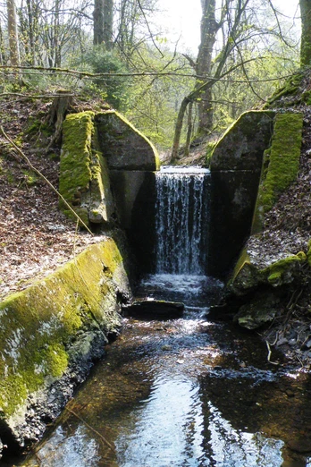
If you go about 30 metres past the beech tree further into the valley, you will find a pretty, albeit artificial, waterfall on the right. With a bit of luck, you might get to see newts or salamanders. Want to save yourself a climb? Then this route is your best option. If you have chosen the alternative route, turn right at the end of the path into “Diepmannsbacher Straße”. There is a very nice miniature golf course here where you can play a round of golf. Further up the road, under the motorway bridges, turn left onto the path that you would have taken on the other route.
Opportunity to take a break at the mountain inn
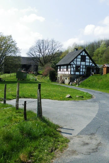
Take the left fork on the farm track, between staked off pastures, towards an old barn and left around the building. You have reached Endringhausen. Passing a lovely stone-plinth, timber-framed building, keep right and follow the road up the hill past a farm. Continue on the road until the next fork. Here, on the left, is the “Wuppertaler Hof” (www.hotel-wuppertaler-hof.de) where you can make a stop.
Back to Lennep train station
Turn right, then immediately left onto Westring, through a residential area. At the next crossroads, turn sharp left on to Schlachthofstraße. When you turn right at the end of this road, you are back on “Karlstraße” where the walk began. The path that leads to the Lennep train station underpass is after the second business on the left-hand side.
Tip: Be sure to plan a visit to the idyllic old town of Remscheid-Lennep after your walk. The Bergisch clothmakers’ town with its pretty timber-framed houses, exciting sights and charming cafés is not something to be missed!
Good to know
Best to visit
Tour information
Familiy-Friendly
Good Connection to public Transport
Loop Road
Loop Road
Tour with Dog
Contact person
Bergisches Land Tourismus Marketing e.V.
Author
Text: Lilian Möntmann, bearbeitet/übersetzt: Supertext/Home of Translation GmbH
Organization
Bergisches Land Tourismus Marketing e.V.
License (master data)
Nearby
