- Photos & Map
How would you like to arrive?
- Description
- Good to know
- Nearby
- 5:10 h
- 19.73 km
- 363 m
- 239 m
- 121 m
- 320 m
- 199 m
- Start: Bus stop Meißen Buschbad
- Destination: Rothschönberg Castle (bus stop at the Kottewitz junction approx. 900 m from the castle)
Hike from Buschbad to Rothschönberg - a nature experience full of history and far-reaching views
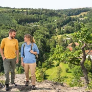
The trail leads through impressive landscapes with sweeping views of fields, forests and winding streams. The tour starts in the Meissen district of Buschbad, a former cold-water sanatorium, directly on the River Triebisch. After a short but crisp climb, you can enjoy a magnificent panoramic view towards the porphyry quarry and the town of Meissen.
Natural beauty of the Triebisch
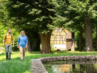
An absolute highlight is the River Triebisch, which accompanies the hike for long stretches. It winds picturesquely through dense forests, ripples through meadows and was once the lifeline for over 50 historic water mills. Some of these mills, such as the Helm and Niedermühle, are located directly along the route and invite you to discover them. The Preiskermühle, with its idyllic resting place by the mill pond, is the perfect place for a break in the shade of old trees.
Historical treasures
A short detour from the route in the village of Taubenheim is definitely worthwhile. Here you can explore the former manor house and castle as well as the charming village church. You can also take a break for coffee and cake or buy regional products in the farm store and café of the "Pfarrgut Taubenheim".
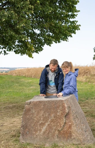
The trail continues uphill to the highest point of the tour, the Baeyerhöhe (320 meters). From here, you can enjoy a breathtaking view that stretches up to 65 kilometers on a clear day. A surveying column and a cozy rest area invite you to linger.
Cultural discoveries
In Burkhardswalde, you will find the smallest castle in Saxony, the Steingut, whose history is still a mystery. The nearby historic "Alma Kasper" inn and the pretty church are also well worth a visit. The last section of the hike surprises with unusual perspectives: The impressive bridges of the A4 are crossed under twice, and at the "Tanneberger Loch" the trail leads directly over the former highway route - today a beautiful piece of nature.
End of the tour: Rothschönberg
Shortly before reaching your destination, you can take a short detour to the main mouth of the Rothschönberg mine, an impressive testimony to the history of mining and part of the UNESCO World Heritage Site "Montanregion Erzgebirge/Krušnohoří". The hike ends at the parking lot on the Schlossberg in Rothschönberg. The castle houses a small but fine exhibition on regional history and mining, and the pavilion in the park offers a hidden view, among other things.
This tour offers a perfect mix of nature, history and culture - ideal for anyone who wants to enjoy the beauty of Dresden Elbland to the full!
You can download the leaflet for the hiking favorite "Through the Triebisch valleys" here:
https://www.dresden-elbland.de/r/611416684?page=media%2Fdownload
Good to know
Best to visit
Directions
The hike starts at the Buschbad bus stop, where there are also parking facilities. The Triebisch river flows just a few meters from the start. The nearby Götterfelsen rock with its shining summit cross can be reached via the Dresden Elbland hiking favorite "Götterfelsenweg".
After an allotment site, the trail follows a path that leads steeply uphill through the forest to Polenzer Höhe. Once at the top, you are rewarded with a beautiful view of the landscape. The trail then crosses Obersemmelsberg and continues along a meadow path and a side road to Preiskermühle, which is located directly on the trail.
The hiking trail now runs along an old railroad embankment of the former narrow-gauge railway line, which is used as a cycle path. Here you pass Hotel Helmmühle and the former Polenz railroad station with a rest area. The route continues past the Niedermühle mill and a scenic section along the Kleine Triebisch river to the village of Taubenheim.
After Taubenheim, a beautiful path follows the meandering stream through meadows and forests. The next striking point is the ascent to Baeyerhöhe, which is moderate and easy to manage.
The ascent is followed by Burkhardswalde. Wide, paved paths, accompanied by wind turbines, lead into the village. At the end of the village, the trail follows a side road to Schmiedewalde. From here, you follow the Schmiedewalder Bach and the Triebisch through a varied natural landscape. The route crosses under two impressive bridges on the A4 highway.
At the Damm-Mühle bus stop, the trail briefly turns onto the road before branching off again onto a meadow and later forest path. This leads in the direction of Rothschönberg. Here it is worth taking a short detour to the main mouth of the Rothschönberg tunnel.
The last 750 meters lead along a steeply ascending side road to Rothschönberg Castle, the destination of the hike. The nearby bus stop Rothschönberg Abzweig Kottewitz is approx. 900 meters from the castle and offers a good option for the return journey. The bus stop can be reached via the Bleiberg road downhill.
Tour information
Cultural Interesting
Stop at an Inn
Directions & Parking facilities
Buschbad: There are parking spaces at the Buschmühle directly at the starting point of the tour
Rothschönberg: There are parking spaces directly at the castle. The bus stop Rothschönberg, junction Kottewitz (line 418) is approx. 900 m away.
Bus from Buschbad: Bus stop Meißen, Buschbad with line 418 to Rothschönberg, Abzweig Kottewitz
Bus from Rothschönberg: Bus stop Rothschönberg, Abzweig Kottewitz with line 418 to Meißen, Buschbad
Additional information
Refreshments
Historic Gasthof Alma Kasper (see homepage for opening hours)
Author
Dresden Elbland Redaktion
Organization
Dresden Elbland
License (master data)
Author´s Tip / Recommendation of the author
Extend your hiking experience and explore the "Triebischtal geological trail " on a second day. The 7-kilometre educational trail from Rothschönberg to Miltitz leads you past 12 information boards through the geological and mining history of the region.
Nearby
