Saxon Wine Trail - Stage 5 - From Oberau to Meißen


- 5:00 h
- 13.11 km
- 172 m
- 195 m
- 101 m
- 191 m
- 90 m
- Start: moated castle Oberau, Thomas-Müntzer-Ring 5, 01689 Niederau
- Destination: Meißen train station, 01662 Meißen
The hiking trail leads past vineyards, wineries and historical evidence of winegrowing, as well as to unique vantage points overlooking the Elbe. Finally, you reach the wine and porcelain town of Meissen with the Wine Experience World of the Meissen Winegrowers' Cooperative. The route is not barrier-free.
Please note! Please find out about the opening times of the various refreshment stops along the way before starting the hike so that you are not faced with closed doors. For example, wine taverns are usually only open at weekends or in spring and fall.

Waypoints


Good to know
Best to visit
Directions
From Niederau station, Germany's oldest railroad station (built in 1842), with public transport connections, it is a short walk to Oberau (water) castle, the starting point of the 5th stage (approx. 1.5 km walk from the station over the railway overpass, right along the path parallel to the tracks, left into Mönchsallee, right into Oberauer Straße, left into Thomas-Müntzer-Ring).
From (Wasser)Schloss Oberau, we follow Thomas-Müntzer-Ring across the castle pond to the west (past the park with playground) and turn left at the park exit (at the agricultural field) into Teichstraße and follow this to Niederau, where we pass the Schwemmteich pond.
We reach Gröberner Straße, walk down it a short distance, turn right and continue along Kirchstraße.
Side trip: From the corner of Teichstraße and Gröberner Straße, it is approx. 1 km on foot up Gröberner Straße to Loose's Besenschänke (please enquire about opening times on 03521/738054) and from there another approx. 1 km on foot to the Steffen Loose winery itself (via Gröberner Straße, Baderberg, Im Winkel) with its nearby handicraft house.
At the beginning of Kirchstraße, we see St. Jakobus Church, which dates back to 1878/79 and is well worth a visit. 200 m further on, we turn left across the Niederau village stream and continue along the path as marked by the signposts to the end of the village (Hauptstraße, crossing Meißner Straße, Rathenaustraße), where we notice a tower windmill (2nd half of the 19th century, privately owned/residential building).
We continue along the Mittelweg through the Nassau, a landscape conservation area with wet meadows, crossing the Fürstengraben and the railroad line to Meißen and reach Ziegelstraße/Köhlerstraße (district road K8015). We turn left and walk along the footpath/cycle path next to the district road until we reach a crossing aid. We change sides of the road, turn right and continue along Köhlerstraße and Langer Graben, which take us to Meißen-Zaschendorf. We come to Heinrich-Heine-Straße, turn right and follow the road until we reach Großhügelstraße.
Here you can take a short detour to the village square in Zaschendorf with its pond, playground and rest area (go down Neuzaschendorf street a short distance).
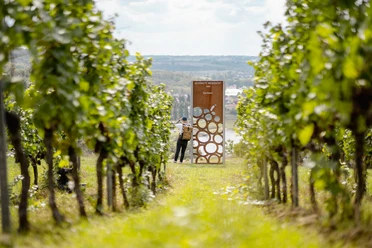
To continue our route, we turn left onto Großhügelstraße and follow the signposts until we reach the Spaargebirge. This almost 3 km long mountain range rises up to 90 m above the Elbe and has favorable climatic conditions compared to the surrounding countryside. For this reason, farms, knights' estates and vineyards have settled here in unusually high numbers since time immemorial (documented from 1352), particularly on the south-facing slopes. These traces can only be discovered with the help of someone who knows the history of the area. Without help, we reach the vineyards and wineries, which also offer individual or guided walks through otherwise inaccessible vineyards.
We turn left into Gelegegasse, which merges into Boselweg and follow Boselweg until we come to a bench and signposts, where the path leads us right up into the forest and to Bosel with the botanical garden (founded in 1930, now managed by the TU Dresden, special features: drought-loving plants, opening hours: April-October every Wednesday, Saturday and Sunday 10 a.m. to 5 p.m.) and the Boselspitze viewpoint - with views of the Elbe valley and, on a clear day, as far as Dresden and Saxon Switzerland.
From the Boselspitze, we continue in the direction of Meißen. After just 200 m, we cross one of the Bronze Age ramparts, of which there are several in the Meissen area. Through a large, mostly closed gate, we have a view of the "Schwalbennest" winegrower's cottage. After a short time, we reach the Boselspitze guesthouse with its Bosel tower and beer garden, which invites us to take a break (open Friday-Sunday & public holidays). We continue along the Boselweg until we turn left onto the Rautenbergweg.
We can enjoy the magnificent views of the Elbe by taking a detour to the "Juchhöh" viewpoint (approx. 10 min. walk).
As small as the Spaargebirge is, it offers numerous marked hiking trails with different "descents" in all directions. We follow the markings of the Saxon Wine Trail (red grape logo with a red S above it) and reach Lückenhübelstraße via Rautenbergweg and arrive at the Ricco Hänsch winery.
Following the further markings (Lückenhübelstraße, right into Rodelandweg), we come to Oberspaarer Straße (refreshment stop: "Bauernhäusl" 1639 with historic wine tavern), cross it and continue along Alte Spaargasse, which leads onto Dresdner Straße.
At the corner of Alte Spaargasse/An der Spaargasse, there is an opportunity to take a detour to the Mariaberg winery.
We cross Dresdner Straße and follow it down the Elbe towards the city, before taking the Elbe cycle path a little later and walking along it to Elbberg Straße (in summer: beach bar with food and drink and beach volleyball court). Turn right up the Elbberg, crossing Dresdner Straße at the traffic lights, to Meißen railroad station and bus station, which offer various options for getting home (S-Bahn S1 towards Coswig, Radebeul, Dresden & bus station with various bus connections). You can stay overnight at the Hotel Ross opposite the train station or the Dorint Parkhotel Meißen (approx. 1 km walk via Großenhainer Straße, Bahnhofstraße, Zscheilaer Straße, Hafenstraße) or numerous accommodation options in the historic old town of Meißen (other side of the Elbe, accessible via the railroad bridge or old town bridge, approx. 10 min walk).
Or - if it's not too late - we decide to visit the WeinErlebnisWelt of the Sächsische Winzergenossenschaft Meißen (approx. 1.5 km walk via Großenhainer Straße, left into Gartenstraße, right into Zscheilaer Straße, right into Joachimstal Straße, left into Bennoweg), the largest wine producer in Saxony. Guided tours of the historic cellars are offered here, wines from all of Saxony's single and large vineyards are available for sale in the modern vinotheque and a wide range of events lives up to the name "WeinErlebnisWelt".
Tour information
Cultural Interesting
Stop at an Inn
Equipment
Sturdy shoes are recommended.
Directions & Parking facilities
From Meißen via the S 80 to Niederau and then left via Oberauer Straße to the moated castle Oberau
Meißen:
from Dresden: A4, exit Dresden-Altstadt via the B6 towards Meißen or A4, exit Wilsdruff via the S177 towards Meißen
from Leipzig: A14, exit Nossen-Ost via the B101 towards Meißen
from Chemnitz: A4 exit Dreieck Nossen via the B101 towards Meißen
from Berlin: A13 exit Radeburg via S177 towards Meißen
directly at the free Elbe parking lot.
P+R parking lot at the Meißen bus station
Parking spaces on the left bank of the Elbe and others in the surrounding area
Parking lot in Oberau:
directly at the starting point (Oberau moated castle)
- Start: with RB 31, RE15, RE18, RE50 to (H) Niederau, Bf or with bus 421, 459 to (H) Niederau, Bf
VVO-Verbindungsauskunft to Wasserschloss Oberau or Niederau station - Destination: by S-Bahn S1 from (H) Meißen, Bf or by bus 401, 404, 407, 408, 409, 411, 412, 413, 414, 415, 416, 417, 418, 421, 422, 426, 428, 446 and city bus lines from (H) Meißen, Busbf
VVO-Verbindungsauskunft from Meißen station
Additional information
Tourismusverband Elbland Dresden e. V.
Dresdner Straße 7
01662 Meißen
Phone: +49 3521 76350
Fax: +49 3521 763540
www.visit-dresden-elbland.de
www.facebook.com/Saechsisches.Elbland
There is a dedicated website for the Saxon Wine Trail with all the information on the individual stages, maps, interesting sights, places to stop for refreshments and much more:
https://weinwandern-sachsen.de/
Attention! Please check the opening times of the various refreshment stops along the way before starting your hike so that you are not left standing in front of closed doors. For example, taverns are usually only open at weekends or in spring and fall.
Author
Dresden Elbland Redaktion
Organization
Dresden Elbland
License (master data)
Dresden Elbland Redaktion

Author´s Tip / Recommendation of the author
- Stop off and taste Saxon wine in wineries, cozy Strauss taverns and wine bars with the title "Especially recommended in the wine country of Saxony"
- Enjoy magnificent vantage points with views of the Elbe Valley
- Travel offers (hiking without luggage)
- AugustusTours
- Corso Reisen
Safety guidelines
The route is not barrier-free.
Map
* 7-part hiking map set "Sächsischer Weinwanderweg" (6.50 euros) - order from bookshops (ISBN 978-3-86843-124-7) or via www.sachsen-kartographie.de (map store, hiking tour guide) or via www.meierwerbung-dresden.de (map sets)
* Hiking and cycling map "Sachsischer Weinwanderweg", Dr. Barthel Verlag (8.90 euros) - order from bookshops (ISBN 978-3-89591-227-6) or via www.verlag-dr-barthel.de (cycling and hiking maps, zig-zag folding)
Nearby

.jpg")