Saxon Wine Trail - Stage 4 - From Radebeul-Zitzschewig to Oberau


- 5:00 h
- 14.84 km
- 127 m
- 115 m
- 119 m
- 205 m
- 86 m
- Start: Corner of Gerhart-Hauptmann-Straße/ Mittlere Bergstraße in Zitzschewig, 01445 Radebeul
- Destination: moated castle Oberau, Thomas-Müntzer-Ring 5, 01689 Niederau
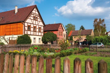
Architectural highlights include the Gellerthaus, Oberau Castle and Germany's oldest railroad station in Niederau. The route is not barrier-free.
Please note! Please find out about the opening times of the various refreshment stops along the way before starting the hike so that you are not left standing in front of closed doors. For example, pubs are usually only open at weekends or in spring and fall.

Waypoints

Good to know
Best to visit
Directions
We start our section of the day at the corner of Gerhart-Hauptmann-Straße/Mittlere Bergstraße (above the Gerhart-Hauptmann-Straße streetcar stop). We walk to the left and turn right into Kynastweg, cross Hausbergweg/Rietzschkegrund (A detour into Rietzschkegrund leads after approx. 800m to the Rößler vineyard with its vacation apartment) and continue along Talkenbergweg - now on Coswiger Flur - to Talkenberger Hof (inn and guesthouse) above the Paulsberg.
At Geschwister-Scholl-Patz, we keep to the right (Spitzgrundstraße), where we can also see the vineyards of the Matyas winery with a wine tavern. We enjoy the wines and sparkling wines produced here in an informal atmosphere. After the break, we follow the signposts (Friedewaldstraße, Am Ameisenhügel, Anton-Günther-Straße) into the Spitzgrund to the Spitzgrundmühlteich.
A short detour down the road leads to the historic Spitzgrundmühle (hotel, restaurant, beer garden), which invites you to stop for a bite to eat.
We cross Moritzburger Straße/Spitzgrundstraße and follow the path to the right over the pond dam into the forest and reach Weinböhla. The state-approved resort can lay claim to being the only place with wine in its name.
On the Spitzberg, we have a good view of the Elbe valley and Coswig before continuing towards Forsthaus Kreyern.
Via the Fuchsberg with its refuge and information board, G-Weg, Neuer Weg and Bergsiedlung path, we reach Lauben Castle, a former 17th century vineyard (now apartments).
Following the signposts (Bergsiedlung, Am Vogel, Bäckersche Hofstraße(Laubenschlösschen restaurant), Wilhem-Wiesner-Straße), we now reach the first of Weinböhla's three towers, the Friedensturm. Built in 1902/03, it offers a comprehensive view from Meißen to the Osterzgebirge mountains. At the foot of the tower is the Drais Stone, dedicated to the inventor of the bicycle.
The next tower (via Hohe Straße, Moritzburger Straße, Karlstraße), the König-Albert-Turm, built at the end of the 19th century and restored in 1999, also offers a magnificent panoramic view of up to 60 km. To gain access to the towers, you can find out about the opening times and key rental stations on the following page: https: //www.weinboehla.de/de/weinboehlas-tuerme.html
As a short detour, finally tower no. 3 after another asphalt road (Barthshügel-, Nizzastraße, Sachsenplatz, Steinbacher Straße) and paths (Helle, Am Börnchengrund): The Wartturm - built in 1900, popularly known as the "ruin" - is the highest point in Weinböhla (over 200 m above sea level).n.N.). From here, we have a view of the Ratsweinberg and the Elbe valley. The restored ruins are accessible all year round.
After turning right into Nordstraße, we enter the fields of Niederau at the end of the road. We turn left onto the D-Weg, walk along the edge of the forest and then continue along the Höhenweg, Am Waldacker (Winzerhof "Im Waldacker") and Gipshügel paths, which lead us to the old vineyards of the Oberau manor. There are still vines here today and the site is known as Gellertberg. This is because there is a small hunting lodge here, which was converted into the Gellerthaus in GDR times because the German poet stayed here in the mid-18th century. An open-air stage was built next to it, which today hosts various events such as open-air cinema, stage shows and open-air concerts.
We leave the complex on a forest path to the right and, keeping left, reach the forest road or Oberer Buschmühlenweg and finally arrive at the Buschmühle, a former sawmill and now a guesthouse and restaurant with a beer garden and gondola pond.
We follow Unterer Buschmühlenweg to Großdobritzer Straße. Before the railroad underpass, we turn right into Am Lerchenfeld and then left into Tunnelweg. We cross Großdobritzer Straße, walk a short distance next to the tracks and turn right into Schulweg, which leads onto Großdobritzer Straße and takes us to the village church of St. Katharina (1680/81), with important gravestones in the cemetery.
We turn right into Oberauer Straße and Thomas-Müntzer-Ring and arrive at Oberau (moated) castle, the destination of stage 4. First mentioned as a moated castle in 1276, it is now awaiting restoration. It is still a short walk to Niederau station, Germany's oldest railroad station (built in 1842), which is connected to local public transport (approx. 1.5 km on foot via Thomas-Müntzer-Ring, turn right into Oberauer Straße, left into Mönchsallee, continue along the path parallel to the tracks to the station). There are various accommodation options, e.g. in Niederau (start of stage 5, https://niederau.info/tourismus/uebernachtungen/, e.g. FeWo im Fachwerkhaus Hof Schwitzky or FeWo Hof Klotz (both Kirchstr.) or Hotel Heidler (Meißner Str.)).
Tour information
Cultural Interesting
Stop at an Inn
Equipment
Directions & Parking facilities
Oberau:
From Meißen via the S 80 to Niederau and then left via Oberauer Straße to the moated castle Oberau
Parking lot in Oberau:
directly at the moated castle Oberau
- Start: by streetcar 4 to (H) Radebeul, Gerhart-Hauptmann-Straße or by S-Bahn S1 to (H) Radebeul Zitzschewig, Bf and then approx. 1 km further on foot
VVO-Verbindungsauskunft to the corner of Gerhart-Hauptmann Straße/ Mittlere Bergstraße, Radebeul - Destination: with RB 31, RE15, RE18, RE50 from (H) Niederau, Bf or with bus 421, 459 from (H) Niederau, Bf
VVO connection information from Niederau station or Oberau moated castle
Additional information
Tourismusverband Elbland Dresden e. V.
Dresdner Straße 7
01662 Meißen
Phone: +49 3521 76350
Fax: +49 3521 763540
www.visit-dresden-elbland.de
www.facebook.com/Saechsisches.Elbland
There is a dedicated website for the Saxon Wine Trail with all the information on the individual stages, maps, interesting sights, places to stop for refreshments and much more:
https://weinwandern-sachsen.de/
Attention! Please check the opening times of the various refreshment stops along the way before starting your hike so that you are not left standing in front of closed doors. For example, taverns are usually only open at weekends or in spring and fall.
Author
Dresden Elbland Redaktion
Organization
Dresden Elbland
License (master data)
Dresden Elbland Redaktion

Author´s Tip / Recommendation of the author
- Stop off and taste Saxon wine in wineries, cozy Strauss taverns and wine bars with the title "Especially recommended in the wine country of Saxony"
- Enjoy magnificent vantage points with views of the Elbe Valley
- Travel offers (hiking without luggage)
- Augustus Tours
- Corso Reisen
Safety guidelines
Map
* Hiking and cycling map "Sachsischer Weinwanderweg", Dr. Barthel Verlag (8.90 euros) - order from bookshops (ISBN 978-3-89591-227-6) or via www.verlag-dr-barthel.de (cycling and hiking maps, zig-zag folding)
Nearby
