- Photos & Map
How would you like to arrive?
- Description
- Good to know
- Nearby
Download GPX file
- 3:30 h
- 11.01 km
- 329 m
- 327 m
- 372 m
- 577 m
- 205 m
- Start: Parkplatz Bürgerallee im Kurort Oybin
- Destination: Parkplatz Bürgerallee im Kurort Oybin
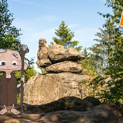
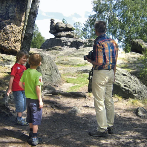
The route starts at the Bürgerallee car park (information board with a little knight) and leads north along the spa gardens to the Oybin railway station. You must cross FriedrichEngels-Straße street (S133, a 30 km/h zone). After passing the station, continue along the foot of the Oybin mountain. The route then follows the blue line trail marker in a northerly direction, running alongside the Goldbach stream. After crossing the narrow-gauge railway track, the route continues along the path that runs through the Talweg Valley. From there, the route makes a right-angle turn, crosses the S133 road, and proceeds northward (still following the blue line) towards the Devil's Mill (Teufelsmühle). From here, the route follows the yellow line in a south-easterly direction to Mount Töpfer. To avoid the shorter but steeper ascent via the Krieche trail (which is not recommended in snowy or icy conditions), you can opt for the more moderate ascent using the yellow circle trail marker. Once you reach the top of Mount Töpfer, you can enjoy the view, provided that visibility is good. Additionally, you can discover The Turtle (Schildkröte), which is slightly hidden behind a hut, and The Broody Hen (Brütende Henne), which is signposted. The route continues from Mount Töpfer, following the green circle trail marker, to a location known as Icy Alley (Eisgasse), and then proceeds through Little Rock Alley (Kleine Felsengasse) until reaching the Scharfenstein Hilltop. For those who are brave, the climb up the steep metal steps is worthwhile. From the Scharfenstein, the route continues to follow the yellow circle trail marker into the Great Rock Alley (Große Felsengasse). However, before entering this, you can take a rest at The Edmund’s Hut (Edmundshütte) shelter. From the Great Rock Alley, you have several views of Mount Oybin and the village below and you can find The Pigeon (Taube) which is signposted. At the end of the Great Rock Alley, you will find the Shell Hall (Muschelsaal), and by now following the yellow line trail marker, you will descend in a northerly direction along the Princes' Path (Fürstensteig) to reach the Rose Stones (Rosensteinen). You can make a worthwhile detour to The Goblet (Kelchstein). From the Rose Stones, the route leads along Bürgerallee street (yellow line trail marker) back to the starting point at the car park.
Good to know
Pavements
Best to visit
Directions
Die Tour startet am Parkplatz Bürgerallee (Infotafel mit dem kleinen Ritter) und führt in Richtung Norden entlang des Kurparkes zum Bahnhof von Oybin. Dazu muss die Friedrich- Engels-Straße (S133) gequert werden (30 km/h-Zone). Am Bahnhof vorbei und am Fuße des Berges Oybin entlang führt die Tour weiter dem Blauen Strich folgend in Richtung Norden entlang des Goldbaches und nach der Querung des Gleises der Schmalspurbahn weiter auf dem Talweg. Vom Talweg aus biegt die Tour rechtwinklig ab und quert wiederum die S133, um danach weiter in Richtung Norden (immer noch Blauer Strich) bis zur Teufelsmühle zu führen. Ab hier folgt die Tour dem Gelben Strich in Richtung Süd-Osten zum Töpfer. Den kürzeren, aber steileren und damit beschwerlicheren Aufstieg über die Krieche (bei Schnee und Eis wirklich nicht zu empfehlen!) kann man umgehen, indem man den moderateren Aufstieg über den gelben Punkt wählt. Auf dem Töpfer angekommen, kann man (bei guter Sicht) die Aussicht genießen, und die Tiere Schildkröte (ein bisschen versteckt hinter der Baude) und die Brütende Henne (ausgeschildert) entdecken. Weiter führt die Tour vom Töpfer mit dem Grünen Punkt zur Eisgasse und danach durch die Kleine Felsengasse zum Scharfenstein. Für die Mutigen lohnt sich der Aufstieg auf die Scharfenstein-Nadel (über steile Metalltreppen). Ab dem Scharfenstein folgt die Tour weiter dem Gelben Punkt in die Große Felsengasse. Bevor man diese jedoch betritt, lädt die Edmundshütte (Schutzhütte) zu einer Rast ein. Von der Großen Felsengasse aus hat man mehrfach einen Blick auf den Berg Oybin und die Ortschaft und kann die „Taube“ (ausgeschildert) entdecken. Am Ende der Großen Felsengasse befindet sich der Muschelsaal und es geht, nun dem Gelben Strich folgend, über den Fürstensteig bergab in Richtung Norden zu den Rosensteinen. Einen lohnenswerten Abstecher kann man noch zu dem Kelchstein machen (etwa 200 m „zurück“ – von den Rosensteinen ausgeschildert). Von den Rosensteinen führt die Tour über die Bürgerallee (Gelber Strich) wieder zurück zum Ausgangspunkt, dem Parkplatz.
Tour information
Loop Road
Stop at an Inn
Tour with Dog
Equipment
Please pack comfortable hiking-boots and enough water!
Directions & Parking facilities
Additional information
BROCKI HAS ANOTHER SECRET TIP: Don't forget to take a detour to The Goblet Stones. It is a great spot for a picnic.
Literature
Author
Christina Czach
Organization
Das Landschaftswunderland Oberlausitz
License (master data)
Author´s Tip / Recommendation of the author
Zittau narrow-gauge railway - Oybin castle and monastery - Upper Lusatian Mini World - Fairy Tale Garden - local playground - GebirgsExpress historic train
Safety guidelines
Please watch your step!
Nearby
