- 2:30 h
- 6.40 km
- 170 m
- 170 m
- Start: Lusen National Park Center, Böhmstr. 41, 94556 Neuschönau
Advice:
Tour of medium difficulty. Refreshments point at Lusen National Park Center (Please inform about the opening hours). Path surfaces: 10.2 kilometers - without winter service, 0.9 kilometers - cleared
Local public transport network:
Igelbus-stop Nationalparkzentrum Lusen
· Line 6204 (Winter-Igelbus) from/to Grafenau and Mauth/Finsterau
· Line 6202 (Winter-Igelbus) from/to Spiegelau/Klingenbrunn and Waldhäuser
For timetables see: www.bayerwald-ticket.com
Navigation:
Parking area Nationalparkzentrum Lusen (fee-paying car park)
Böhmstr. 41
94556 Neuschönau
Stages:
Lusen National Park Center – Sagwassersäge – Große Kanzel – Felswandergebiet – Sagwassersäge – Lusen Nationalpark Center
Tour description:
We start our tour at the Lusen National Park Center (805 meters above sea level). At the information point behind the toilet facility, we see the signpost 'Tanne' and follow it in direction of Sagwassersäge. The path leads gently uphill through a part of the animal enclosures. Passing a large aviary, where we can observe typical woodland-dwelling birds, we reach a crossroads. There is the possibility for a short detour to the wisent enclosure, where one might spot some of the imposing animals. At the crossroads, we follow the ‘Tanne’ to the right in direction of Sagwassersäge. After a few meters, we cross a road and then the forest trail leads through typical mixed mountain forest of beech, fir and spruce on uneven surface. The way divides then. We stay on the trail 'Tanne' and turn right downhill the steepening trail. On both sides of the trail lie impressive deadwood tree trunks between enormous boulders. We reach the Sagwassersäge (790 meters above sea level) on a wooden bridge over the Sagwasser. The 'Tanne' is still the signpost we follow - now our destination is Mauth.
First, another hiking trail branches off to the left, later to the right hand side. We follow the sign ‘Tanne’ and continue gently but steadily uphill along the Seebach. At the next crossroads, we meet the main hiking trail in the national park with the signpost ‘Hauptwanderweg Baumgruppe’. Here, we turn right towards the Felswandergebiet. At the next crossroads, a detour to Große Kanzel can be made on the left hand side (signpost ‘Eberesche’, about 10 minutes). Then we walk a few meters on a narrow path. We reach the viewing rock by climbing up the boulders (1002 meters above sea level – danger: it might be slippery in case of bad weather and snow!). On the same way back, we reach the main hiking trail crossroads again.
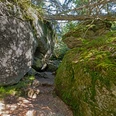
Now we follow the sign of ‘Hauptwanderweg Baumgruppe’ to the left in the direction of Sagwassersäge. On a narrow path, we walk past enormous rocks and overturned trees through the Felswandergebiet (1000 meters above sea level). We continue our tour through boulders, which are covered with mosses and lichens, and always stay on ‘Hauptwanderweg Baumgruppe’. At the Ochsenriegel refuge, we continue straight on until we return to Sagwassersäge. Here, we switch the sign and follow ‘Arnika’ now towards Lusen National Park Center. After crossing the national park road, we enter the forest again. At the next crossroads, ‘Arnika’ leads us to the right. If you take a closer look, you can see the relics of the former Spiegelauer Waldbahn: the trail leads continues an old railway embankment in some sections. On a flat path, we return to Lusen National Park Center.
Correct on the go – all the time:
- Always ensure to have good equipment: card, sturdy shoes, something to drink, first aid kit, bad weather clothing.
- Beware of falling trees and deadwood! The use of the path is at your own risk. In case of strong wind, please leave the forest for safety reasons.
- Path regulations in order to protect endangered plants and animals in certain areas of the national park
Did you know it?
Enormous boulders of gneiss and its native forest area characterize the Felswandergebiet, a ridge with a height of up to 1000 meters east of Lusen National Park Center. The rocks can be traversed on mystical and narrow paths. The interplay of boulders, trees and deadwood within the steep terrain make this area unique and popular as a destination. There is strict path regulation within the Felswandergebiet. Leaving the signposted trails is prohibited, in order to protect endangered animal and plant species.
The rail Network of the Spiegelauer Waldbahn was built at the beginning of the 20th century, in order to facilitate timber transportation from the woodlands around Spiegelau. Starting from train station Spiegelau, a main line to Mauth (23 kilometers away), as well as several short branch lines were built. It was a narrow-gauge railway with 600 millimeters of track gauge. At the end of the 1950s, timber transportation with the Waldbahn ended, as the necessary overhaul of the railway would have been too expensive. Next, there was a complete dismantling of these tracks. Today, remnants of the former railway embankment can still be found in this area. In some places, the routes are now used as hiking trails.
Good to know
Best to visit
Tour information
Climbing Site
Loop Road
Loop Road
Nature Highlight
Stop at an Inn
Suitable for Winter
Summit
Contact person
Author
Nationalparkverwaltung Bayerischer Wald
Organization
Nationalparkverwaltung Bayerischer Wald
License (master data)
Nearby


