- Photos & Map
How would you like to arrive?
- Website
- Description
- Good to know
- Nearby
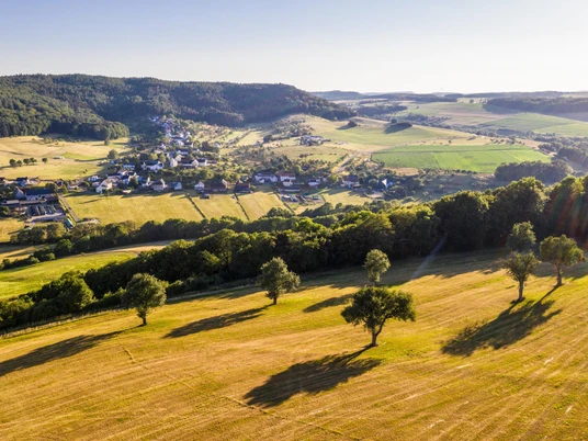
The Ferschweiler Plateau rises 200 metres above the Sauer and Prüm valleys. It is one of several wooded plateaus in the German-Luxembourg border region, characterised by greyish-yellow sandstone, and is named after one of the two villages located up here. Scenic beauty and historical significance - these two factors have made the approximately 8 x 4 kilometre Ferschweiler Plateau famous.
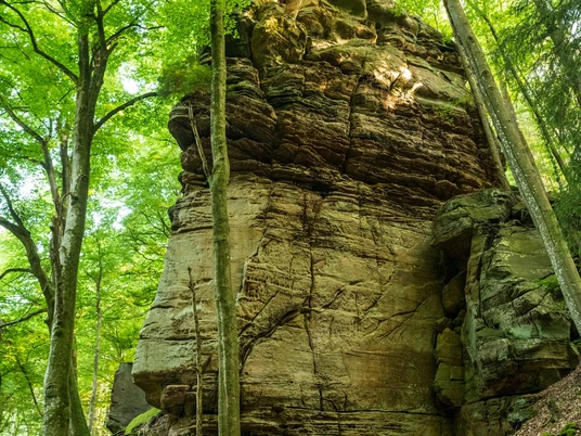
Numerous hiking trails criss-cross the plateau and its slopes. They reveal cultural monuments from all eras of history and lead to natural beauties of unforgettable uniqueness. Anyone who has ever hiked along one of the many paths along the edges of the plateau, past bizarre rock towers, through gorges and crevices, will be left with impressive images.
The adventurous rocky landscape has a fascinating history: Walking through it is like walking on a 190-million-year-old seabed. The grains of sand have now become a block of rock up to 70 metres thick. The rock faces are covered with bizarre weathered shapes - holes and cavities, ridges and grooves. Events around 12,000 years ago, towards the end of the last ice age, made a decisive contribution to the appearance of this landscape today. The glacial climate caused frost heave and thus huge rockfalls and landslides. Large and small sandstone blocks tore off the edges of the plateau and slid down the slopes. The most famous natural monuments on the Ferschweiler plateau, the Devil's Gorge and the Irrel Waterfalls, were created by such glacial rock slides and falls.
Nearby
