- Photos & Map
How would you like to arrive?
- Description
- Good to know
- Nearby
Download GPX file
- 2:10 h
- 7.57 km
- 183 m
- 183 m
- 102 m
- 285 m
- 183 m
- Start: Hikers' parking lot "Holzhauser Berg", Rumenstraße, 32361 Preußisch Oldendorf
- Destination: Hikers' parking lot "Holzhauser Berg", Rumenstraße, 32361 Preußisch Oldendorf
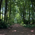
The A3 starts at the "Holzhauser Berg" hiking parking lot and ends after approx. 7.5 km back at the starting point. The trail leads through varied woodland structures. After a good third of the way, you will pass the Babilonie, a former rampart.
Good to know
Pavements
Unknown
Street
Asphalt
Gravel
Trail
Best to visit
suitable
Depends on weather
Tour information
Familiy-Friendly
Loop Road
Equipment
Sturdy shoes are recommended.
Directions & Parking facilities
Take the B65 in the direction of Heddinghausen.
Parking is available at the "Holzhauser Berg" hiking parking lot.
Holzhausen/Heddinghausen train station is approx. 2 km away from the "Holzhauser Berg" hiking parking lot.
Always know what's running when: The "smart number" for buses and trains in NRW: 08006 504030.
Additional information
Further information and maps are available from the Tourist Information Office in the Haus des Gastes in Bad Holzhausen, Hudenbeck 2, 32361 Preußisch Oldendorf, Tel.: 05742-9311200. The Tourist Information Office is open Monday to Friday from 9.00-11.30 am and from 2.30 pm to 4.30 pm.30 am and from 2.30 pm to 4.30 pm.
Take a look at our homepage: tourismus.preussischoldendorf.de
Author
Christian Streich
Organization
Stadt Preußisch Oldendorf
License (master data)
Nearby
