- Photos & Map
How would you like to arrive?
- Description
- Good to know
- Nearby
Download GPX file
- 1:20 h
- 19.88 km
- 179 m
- 183 m
- 181 m
- 281 m
- 100 m
- Start: ADFC Station Bad Meinberg - Brunnenstraße 67
- Destination: ADFC Station Bad Meinberg - Brunnenstraße 67
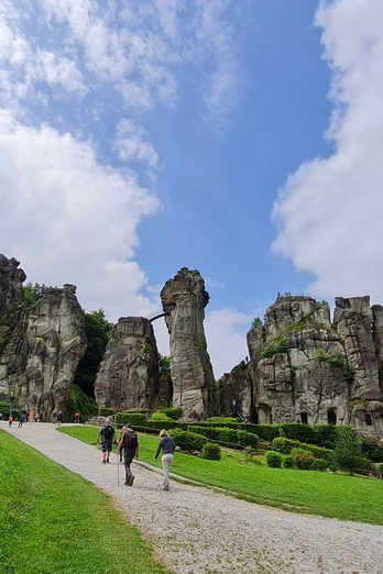
While you are on your way to the impressive Externsteine, you can enjoy the charming old town of Horn and the idyllic rural surroundings that surround this unique natural and cultural monument.
Good to know
Pavements
Best to visit
Directions
We start at the ADFC station in Bad Meinberg, follow "Parkstraße" to the right along the park and turn left into the shopping street "Allee". At the crossroads, turn left into "Marktstraße". We cross "Hamelner Straße" at the pedestrian crossing, follow the street "Auf der Heide" and the signs "Moorstich" + "Wellness-Radroute" this quiet residential street leads us quickly down to the "Bergwerk des Staatsbades Meinberg"
.The rest of the route is signposted "Silbermühle" and leads past the company premises on the right as a gravel path, which later narrows and leads us as a very narrow hiking trail over a small stream, through meadows and past a bush forest, reaching the next asphalted farm track after 600 m. Here we continue straight up the hill until we reach the L 823, we keep right onto the cycle path to the "Napteweg" bus stop and change to the farm track opposite. The asphalt path leads us to the K 94, then right and straight ahead into the "Heller Weg", after 60 m left, cross the "Bellenberger Straße" with the further course of the hiking and cycle path to the Silbermühle. Next, we cross the L 616 and follow the farm track straight ahead - with the B 1 to our left in the dip in the terrain - , a gravel path leads us to a single residential building, here we turn left on the asphalt path, a bridge leads us over the B 1, then immediately right into "Mühlenweg", followed by a small level crossing and through the fields and meadows to a junction to the right - km 5.0 - with the cycle sign "R 3 b". The asphalt path crosses the bypass and we reach the first housing estate through Hornsche Kämpen. Here we cycle straight ahead into "Heideweg", turn right into "Heckenweg", at the end of which we turn left into "Röddepöhler Weg", meet the L 954 "Leopoldstaler Straße" and keep right into the town center of Horn.
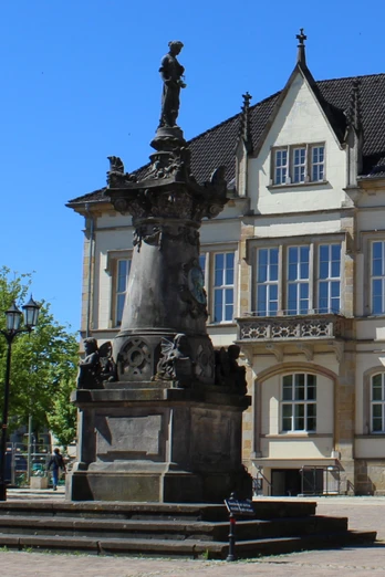
At the crossroads with traffic lights, turn left into the pedestrian zone - "Mittelstraße" - and reach the market square. Continue along "Mittelstraße", cross the "Potthof" junction straight ahead and follow "Paderborner Straße" instead of "Externsteine". At the pedestrian lights, turn right into "Jahnstraße" and continue straight ahead slightly uphill in this quiet residential street. At the end of "Jahnstraße", we return to "Paderborner Straße", keep right and arrive at the "Waldschlößchen" excursion restaurant on the hiking parking lot that branches off to the right. "Hermannsweg".
At the halfway point of the long parking lot, turn right onto the asphalt forest path and continue uphill along the Krebsbach stream, through the forest and past the protected nests of the little wood ant. At the next junction with the NRW cycle route network, we turn right and follow the path, which is much frequented by hikers. It goes quickly downhill and we soon reach the Externsteiner See lake. Here we turn right onto the wide gravel path, which leads us directly through the mighty Externsteine rocks.
Our further route takes us to the left over the dam of the lake, at the end we keep right towards Holzhausen and now follow the gravel forest path slightly uphill. After 600 m we reach the first houses of Holzhausen, continue straight ahead on the "Schliepsteinweg" over the "Am Bärenstein" crossroads, now downhill, keep right at a prominent hairpin bend into "Langestraße" and cross the L 828 "Externsteiner Straße" straight ahead into the field path. This leads us uphill and we soon reach the top. We follow the asphalted farm track straight ahead until it meets a crossroads at the "L 34 Meinberg" electricity distributor, where we turn right and pass a few farms in the direction of Horn.After passing the Horn town sign (km 14.9), we continue straight ahead along the quiet residential road "Zum Rosenbusch" and reach the "Nordstraße "+"Potthof" traffic circle, where we continue straight ahead into the old town of Horn. Nordstraße" brings us to the traffic lights at the crossing of "Mittelstraße", here we turn left and follow the traffic-calmed area of "Mittelstraße", then we come to "Bahnhofstraße" at "Alte Post - Haus der Jugend", we change to the accompanying cycle/footpath, pass the "Hessenring" traffic circle, cross the railroad line and pass the factory premises of "SOANA / GLUNZ (ex.Hornitex)". We follow the "Bahnhofstraße" over the small hill of the "Kreuzenstein" and descend to Bad Meinberg. At the traffic circle on the B 239, we keep straight on into the "Allee" and after 20 km we have reached the starting point again.
Tour information
Familiy-Friendly
Loop Road
Stop at an Inn
Equipment
Directions & Parking facilities
A2, exit 35 Bad Eilsen, towards Rinteln, bypass, then via Barntrup and Blomberg towards Paderborn to Bad Meinberg.
With the bus lines 776, 772, 782, 792 to Bad Meinberg bus station
.Additional information
Author
Stadtmarketing Horn-Bad Meinberg
Organization
GesUndTourismus Horn-Bad Meinberg GmbH
License (master data)
Safety guidelines
We recommend that you wear a bicycle helmet.
Please pay attention to the road safety of your bike.
Be considerate of hikers.
Please take care when crossing the roads.
Map
Nearby
