- Photos & Map
How would you like to arrive?
- Description
- Good to know
- Nearby
Download GPX file
- 2:45 h
- 25.05 km
- 353 m
- 343 m
- 221 m
- 386 m
- 165 m
- Start: Parking lot Jägerweg
- Destination: Parking lot Jägerweg
The cycle paths around Bad Wünnenberg are marked with red and white NRW cycle signs (labeled WÜ =Bad Wünnenberg 1 to 8) and vary in length from 9 km to 25.1 km. They lead partly through meadows and fields but also through forests around Bad Wünnenberg. Most of them are asphalted and therefore easy to cycle on.
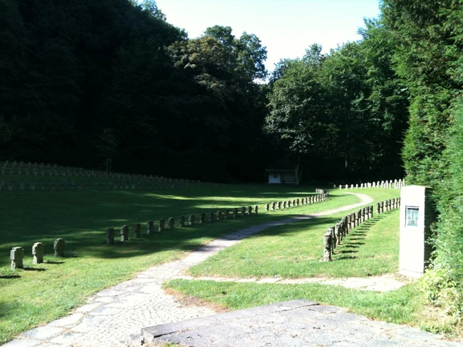
The WÜ 1 cycle route has a length of 25.1 km. It starts and ends at Jägerweg in Haarener Wald. The route is varied and easy to cycle. There are ascents and descents as well as flat sections. You start your cycle tour in Haaren Forest. The route takes you into the "Valley of Peace", where war graves commemorate the victims of the Second World War. The Meinolfus Chapel, which is next on the route, is the burial place of the von Mallinckrodt family, an old noble family. If you continue on, you will reach the Böddeken estate. This is still run by the Mallinckrodt family today and is home to a boarding school and a residential elementary school. From here, the tour continues through the small agricultural settlement of Tindeln, which belongs to Haaren. There is a thousand-year-old lime tree here. The route then continues to the district of Haaren. This is one of the oldest settlements in the Sintfeld. There is a Jewish cemetery on the edge of the road at the end of the village. The cemetery was established in 1745. The oldest gravestone probably dates back to 1852 and there are other gravestone foundations in the ground. From here, the path continues to Helmern. Helmern won the "Our village should become more beautiful" competition in 1973. The route continues through Sintfeld, where you have wonderful views of both the Sauerland and the Paderborn plateau. You cycle along the Königsweg "Hirschweg", an old trade route on which merchants traveled in the Middle Ages, and return to your starting point.If you are traveling by bus rather than by car, it makes sense to start and end the tour in Haaren, as there is no bus stop at the starting point mentioned above.
Good to know
Best to visit
Directions
Tour information
Familiy-Friendly
Loop Road
Equipment
Directions & Parking facilities
If you are traveling by bus, it makes sense to start and end the tour in Haaren, as there is no bus stop at the starting point mentioned above.
Take the train to Paderborn main station; from there, take the fast bus S10 (until 05.08.18: S80) in the direction of Bad Wünnenberg - Haaren, stop Volksbank
Additional information
Further information and GPS devices are available from Bad Wünnenberg Touristik GmbH at:
Author
Kneippheilbad Bad Wünnenberg
Organization
Bad Wünnenberg Touristik GmbH
License (master data)
Author´s Tip / Recommendation of the author
Nearby
