


- 2:28 h
- 8.92 km
- 146 m
- 150 m
- 280 m
- 414 m
- 134 m
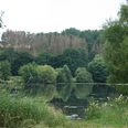
Our route begins at the church square and takes us along Hepernstraße. We pass the cemetery and the sports field and finally reach the Weiberg junction (Arens Kreuz). From up here, we have a view over the Sauerland as far as the Bruchhäuser Steinen. We turn right and shortly afterwards follow the path on the left to the Hepernkreuz. This cross is a reminder of the former parish village of Hepern, which was mentioned as early as 1200 and was destroyed in the 15th century during the Soest feud.
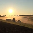
At the Volbrexen crossroads, we turn right and enter Molmschen Forst. We continue straight on across the forest crossroads, past the Klaus'Kreuz and reach the Letten Kreuz. Our path now leads us downhill onto Almestraße to the right. After a few hundred meters, a sign points the way to Harth via Grünnenweg, back to the village.
At the Volbrexen crossroads, we turn right and enter Molmschen Forst. We continue straight on across the forest crossroads, past the Klaus'Kreuz and reach the Letten Kreuz. Our path now leads us downhill onto Almestraße to the right. After a few hundred meters, a sign points the way to Harth via Grünnenweg, back to the village.
Good to know
Best to visit
suitable
Depends on weather
Tour information
Loop Road
Author
Kreis Paderborn | Wirtschaft & Tourismus
Königstraße 16
33142 Büren
License (master data)
Kreis Paderborn | Wirtschaft & Tourismus

Nearby
