- Photos & Map
How would you like to arrive?
- Call
- Description
- Waypoints
- Good to know
- Nearby
- 62:00 h
- 225.46 km
- 4,096 m
- 3,666 m
- 30 m
- 462 m
- 432 m
- Start: Rheine train station
- Destination: Marsberg
Hermannsweg - cultural trail for explorers
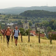
The 156 km long Hermannsweg is considered one of the most beautiful high-altitude trails in Germany. It runs along the ridge of the Teutoburg Forest through the two nature parks "TERRA.vita" and "Teutoburg Forest / Eggegebirge". Its name is derived from Hermann the Cheruscan, who defeated the Roman general Varus in the year 9 AD and defeated three Roman legions.
Starting in the Münsterland parkland in Rheine, the Hermannsweg leads over heights of 100 to 400 m to Horn-Bad Meinberg. There it ends on the 441 m high rock formation of the Lippische Velmerstot, from where you have a magnificent view of the surrounding area.
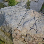
The Hermannsdenkmal, one of the many sights and attractions that line the route, as well as the Dörenther Klippen, the Externsteine, the Sparrenburg in Bielefeld and the Adlerwarte Berlebeck, are reminders of the historical events. With its mountain ridge interrupted by numerous valleys, the trail offers a varied elevation relief with far-reaching views of the landscape.
There are many other witnesses to living history along the way: historic town centers, castles and monasteries, museums and fortifications such as Ravensberg Castle document the events of past eras. The varied geological composition of the subsoil and interesting places with historic town centers such as Tecklenburg or Bad Iburg make this tour not only a nature experience but also a cultural one.
Eggeweg - hiking trail for nature lovers
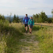
From north to south, the Eggeweg crosses the Eggegebirge mountains from north to south and always leads over the ridge of the mountain range. Over a length of 70 km, this trail, the first "Wanderbares Deutschland" quality trail, connects the Teutoburg Forest mountain range in the north with the Sauerland in the south.
This mountain trail was used as a military and trade route in prehistoric and early historical times. Today, nature lovers and hikers enjoy this scenic nature trail in the Eggegebirge and Southern Teutoburg Forest Nature Park. The settlement-free ridge path leads from the Externsteine in the north through the Silberbachtal valley to the 468 m high Prussian Velmerstot, the highest elevation in the Teutoburg Forest and Egge mountains.
The route continues southwards along the wooded Eggeweg, which offers a number of charming views. On the way to Marsberg in the Diemel Valley, there are many natural sights and a number of witnesses to the eventful past to discover - for example the Iburg ruins, the Blankenrode deserted town, the lead caves, the Bierbaums Nagel observation tower and numerous impressive cliffs, such as the Teutonia cliffs.
A good interactive map can be found here:https://www.outdooractive.com/en/route/distance-trail/hermannshoehen-der-ganze-trail/16952334/
Here's the life!
Homepage of the Hermannshöhen: www.hermannshoehen.de
Bookable offers: https://hermannshoehen.teutoburgerwald.de/gastgeber-pauschalenWaypoints
Good to know
Pavements
Best to visit
Directions
New variants were added to the traditional route for the certification of the Hermannsweg. This tour tip describes the certified route. Alternative routes can be used in Tecklenburg, Bielefeld-Bethel and Bielefeld-Lämershagen.
Hiker-friendly accommodation along the Hermannshöhen is designated as a "Hermannshöhen quality establishment" and marked as a recommendation in the stage suggestions.
The Eggeweg is marked with a white horizontal cross (St. Andrew's cross, X1) in both directions by the Eggegebirgsverein. For the first few kilometers, it also runs parallel to the Hermannsweg "H". The Eggeweg is a section of the European long-distance hiking trail E1.
Hiker-friendly accommodation along the Hermannshöhen is designated as a "Hermannshöhen quality establishment" and marked as a recommendation in the stage suggestions.
Tour information
Cultural Interesting
Familiy-Friendly
Good Connection to public Transport
Labelling
Multiday Tour
Nature Highlight
Possibility of Accommodation
Premium Trail "Wanderbares Deutschland"
Stop at an Inn
Suitable for Winter
Tour with Dog
Equipment
Directions & Parking facilities
Start of the tour: Rheine train station (also long-distance Hanover-Amsterdam).
Other train stations with access routes to the Hermannsweg: Hörstel, Ibbenbüren, Lengerich, Hilter, Dissen/Bad Rothenfelde, Borgholzhausen, Halle/Westphalia, Steinhagen, Bielefeld, Oerlinghausen, Lage/Lippe, Detmold, Horn-Bad Meinberg, Leopoldstal.
Always know what's going on: The NRW smart number:
08006 - 50 40 30 (free of charge from a German landline)
Additional information
Literature
Date of publication: 2022 (4th edition)
Overall route Hermannshöhen (250km). Edition)
Total route Hermannshöhen (250km): scale 1: 35 000, weatherproof
Hiking map, city maps, list of overnight accommodation, elevation profile, thread stitching
ISBN: 978-3-85000-767-2
Price: €12.90, in bookshops
OUTDOOR hiking guide: Hermannsweg-Eggeweg
Publication date: March 2019 (4th edition)
Hiking guide: Hermannsweg-Eggeweg
Publication date: March 2019 (4th edition) Edition)
About the Hermannshöhen - interesting facts, accommodation, sights, stages, elevation profiles, hiking maps
ISBN: 978-3-86686-621-8
Price: €12.90, in bookshops or at the publisher's webshop
Contact person
Teutoburger Wald Tourismus
Author
Annika Lammers
Organization
Projektbüro Hermannshöhen
License (master data)
Safety guidelines
Disturbance reports:
Please take sun protection and drinks with you on the Eggeweg if necessary. Many formerly wooded stretches now have little shade due to clearing. Unfortunately, there are no refreshment stops along the way - except in Willebadessen and Bad Driburg.
Map
Publication date: 2021
Leporello: Scale 1:50.000, waterproof, tearproof, GPS-accurate
City maps, elevation profile, information on places of interest, list of overnight stays, refreshment stops
ISBN: 978-3-85026-984-1
Price: €8.99, from bookshops
Our recommendations
Nearby


