Hiking Route ‘Ahorn' (Maple) (Spiegelau - Racheldiensthütte)

- 4:45 h
- 14.50 km
- 470 m
- 110 m
- Start: P+R Spiegelau, Konrad-Wilsdorf-Str. 1b, 94518 Spiegelau
- Destination: Racheldiensthütte, 94566 St. Oswald-Riedlhütte
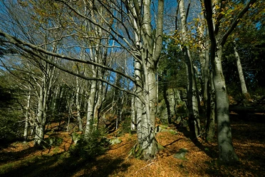
The 'Ahorn’ (Maple) trail starts from the settlement of Rehbruck near Grafenau and follows the valley of the Große Ohe river to Spiegelau. From there, the 'Ahorn’ (Maple) hiking route continues from Spiegelau through the Waldspielgelände (forest playground) and the Föhrau-Filz to the Racheldiensthütte.
Good to know
Best to visit
suitable
Depends on weather
Contact person
Author
Nationalparkverwaltung Bayerischer Wald
Freyunger Str. 2
94481 Grafenau
Organization
Nationalparkverwaltung Bayerischer Wald
License (master data)

Nearby