- 3:00 h
- 34.86 km
- 70 m
- 71 m
- 65 m
- 74 m
- 9 m
- Start: car park at swimming pool "Cabrioli" in Lippstadt
- Destination: Vellinghausen
The Lippe floodplain is located in the north of the District of Soest. The state of North Rhine-Westphalia, Lippe River Management Association and the NRW Foundation undertake a great deal of conservation work in the Lippe floodplain. Since the mid-1990s, about 15 km of the Lippe have been restored.
The Lippe floodplain is rich in different habitats: The gently flowing River Lippe, meadows and pastures, dry sand heaths, tall forb communities, small woods, ponds, pools and streams. The Tall Oat-Grass meadows and the wet meadows offer habitats for rare species of plant: Pepper Saxifrage, Yellow Meadow Rue, Meadow Fleabane and Yellow Rattle all grow here. The sandy river terraces are the realm of specialist plants: Petty Whin, Small Cudweed and Heather cope here with the nutrient-poor conditions that make life impossible for other species.
Wading birds such as Snipe and Greenshank, duck species like Widgeon and Teal, as well as Cranes, are just some of the species that overwinter in the Lippe Floodplain or stop off during migration.
Good to know
Pavements
Best to visit
Directions
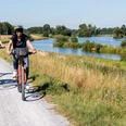
Along the route you will find observation huts, viewpoints and seats. A number of information boards inform you about various topics.
Alternatively, you can explore the Lippe by the shorter tours "Lippeaue Lippborg" and "Lippeaue Herzfeld".
Tour information
Stop at an Inn
Equipment
Directions & Parking facilities
Address for satnavs:
Pastorat: Kirchweg 1, 59556 Lippstadt
Herzfeld: Kreuzweg, 59510 Herzfeld
Lippborg: Illmerweg 3, 59510 Lippborg
GPS (UTM):
Pastorat: 32 U 450910, 5724372
Herzfeld: 32 U 440850, 5723546
Lippborg: 32 U 433481, 5724242
Google coordinates:
Pastorat: 51.668164, 8.290456
Herzfeld: 51.659857, 8.144715
Lippborg: 51.665260, 8.037987
Additional information
On the "Auenland" cycle path, you pass the museum railway station Museumsbahnhof Heintrop between Vellinghausen und Lippborg.
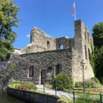
In Herzfeld you can visit the St. Ida Basilika and in Hovestadt enjoy the baroque garden of the stately home Schloss Hovestadt.
In the parish church of St. Clemens you can see the famous "stone bread".
Author
Petra Salm
Organization
Arbeitsgemeinschaft Biologischer Umweltschutz im Kreis Soest e.V
License (master data)
Petra Salm

Nearby