Munich Waterway


- 6:00 h
- 81.45 km
- 727 m
- 525 m
- 508 m
- 882 m
- 374 m
- Start: Gmund am Tegernsee
- Destination: Munich
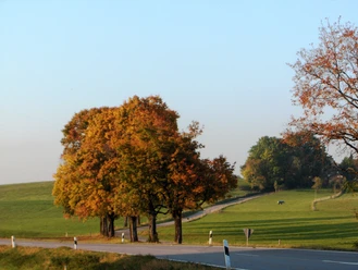
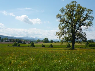
The M-Wasserweg offers several routes between 39 and 82 kilometers, thus many options for cyclists and hikers, for athletes and family excursions. At various points it crosses S-Bahn or BRB stations. Along the way, a total of 20 information boards point out visible and "invisible" extraction facilities, pipelines, and constructions that play an important role in Munich's water supply. Above all, the M-Wasserweg leads through idyllic landscapes. Many sights along the M-Wasserweg are worth a visit; beer gardens and inns in the Munich and Miesbach districts invite you to pause and linger.
By the way: the M-Wasserweg is also the location of the digital treasure hunt by LET°S GEO! Under the motto "Tracing Munich's drinking water," exciting puzzles can be solved! Here is the route. Here you can find the download link for the app.
Author: Tegernsee Schliersee Alpine Region Tourism Association KU, Stadtwerke München
Good to know
Best to visit
Tour information
Cultural Interesting
Author
Stadtwerke München GmbH
Organization
Alpenregion Tegernsee Schliersee
License (master data)
Nearby