- Photos & Map
How would you like to arrive?
- Description
- Good to know
- Nearby
Download GPX file
- 1:30 h
- 19.91 km
- 174 m
- 157 m
- 103 m
- 256 m
- 153 m
- Start: Feeder route: junction 56 in Bielefeld Mitte, Niederwall, round trip: junction 35 in Stieghorst, corner Schneidemühler Straße/Stettiner Straße
- Destination: Feeder route: junction 56 in Bielefeld Mitte, Niederwall, round trip: junction 35 in Stieghorst, corner Schneidemühler Straße/Stettiner Straße
Enjoy the beautiful views of the Ubbedisser Berg and the city center and treat yourself to a refreshing dip in the Hillegossen outdoor pool after the ride through the Teutoburg Forest!
(!) Feeder route from the district court (2x 5 km):
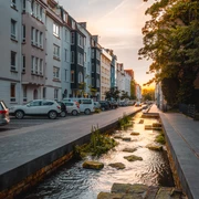
The feeder route from the city center to the east of Bielefeld is flat and ideal for rolling in. The paths in Stieghorster Park follow the course of the Baderbach stream and its tributaries - often within sight of the tram line 3.
The circular route:
On St. Nicholas Day in 1894, the first lessons took place in the old Frordissen school. There were 150 pupils in two classrooms.
Slightly off the route, on Detmolder Straße, you will see the mighty 2 1/2 meter high Landesgrenzstein, which once marked the border between the Kingdom of Prussia and the Principality of Lippe.
The path leads back to Gräfinghagener Straße above the Sussieksbach stream, where further border stones can be seen directly by the stream. This historic boundary was elaborately secured with 63 stones in 1784.
The route then continues in a wide arc around the Ubbedisser Berg. The nature reserve is at its most beautiful in midsummer. On the slopes of the Teutoburg Forest, calcareous grasslands have developed outside the wooded areas as a result of centuries of grazing, which are characterized by a high abundance of species and flowers. Butterflies such as the imperial cloak and swallowtail can be found here.
After a long and sometimes strenuous ride through the Teutoburg Forest, treat yourself to a dip in the Hillegossen outdoor pool! The small, cozy outdoor pool is located on the outskirts of Hillegossen and offers lots of fun for young and old alike, both in the water and on the lawns.
Good to know
Best to visit
Directions
(!) Feeder route:
Follow these junctions from junction 56: 56 - 26 - 38 - 35.
Round trip:
Then follow these nodes clockwise for the round trip: 35 - 80 - 84 - 87 - 86 - 77 - 78 - 35.
You can shorten or extend your tour "Cycle tour tip 6 Stieghorst and Gräfinghagen" at any time along the way, as the tour runs entirely within the junction network. Signposts at the cycle route intersections (the junctions) show you the way to the next town, a nearby attraction or the train station. Large signs along the route inform you about other leisure cycle routes.
Recreational cycle routes BielefeldTour information
Loop Road
Stop at an Inn
Directions & Parking facilities
Light rail stops Landgericht (line 2), Sieker (line 2) and Stieghorst (line 3)
.Bielefeld-Oldentrup and Ubbedissen stations.
Always know what's running: the smart number for buses and trains in NRW: 01806 504030
( 20 cents/connection from landlines and a maximum of 60 cents7 connection from mobile networks.)
Additional information
The leaflet "Radtouren-Tipp 6 Stieghorst und Gräfinghagen" is available free of charge from the Bielefeld Tourist Information Office, the district offices and the ADFC Bielefeld.
Literature
The leaflet "Radtouren-Tipp 6 Stieghorst und Gräfinghagen" is available free of charge from the Bielefeld Tourist Information Office, the district offices and the ADFC Bielefeld.
Author
Stadt Bielefeld, Amt für Verkehr
Organization
Bielefeld Marketing GmbH
License (master data)
Author´s Tip / Recommendation of the author
In the district of Ubbedissen, the signposted, 20-kilometre-long "Lämmerweg" crosses your path. If you walk a few hundred meters on the path to the northeast (towards Naturfreundehaus Teutoburg), you will come to the Ubbedisser Berg nature reserve with its species-rich lime-beech forest and extensive grassland areas. Access to the hiking trail: near junction 77 at the house at Oerlinghauser Straße 137
Safety guidelines
The tour leads along side roads, park paths and cycle paths and is easy to cycle. The flat feeder route is followed by a steeper path along the historic border in the east of Bielefeld.
Some sections lead along private paths. We would like to thank the owners for their permission to use the paths.Map
The leaflet "Radtouren-Tipp 6 Stieghorst und Gräfinghagen" is available free of charge from the Bielefeld Tourist Information Office, the district offices and the ADFC Bielefeld.
Nearby


