- 3:00 h
- 13.12 km
- 170 m
- 340 m
- 448 m
- 674 m
- 226 m
- Start: Lahn source
- Destination: Village center in Netphen-Irmgarteichen
The route begins at the source of the Lahn and leads directly to the Ilse source, which is not known for its size but for its mysterious healing powers. The Ilse was especially considered a holy spring in the Middle Ages and was a pilgrimage site for many years.
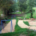
From the Ilse source, the Rothaarsteig leads to the Jagdberg (674m), the highest point in the Lahn-Dill district. Over the Haincher Height, the path reaches the rest area "Kaffeebuche," from which you can enjoy a beautiful view of the Johannland. Down in the valley lie the two villages of Hainchen, with the only elevated water castle in Westphalia, and Irmgarteichen. After crossing the district road, you now take the yellow-marked access path "Irmgarteichen North" at the end of the hiking parking lot to reach Irmgarteichen.

Good to know
Best to visit
Tour information
Cultural Interesting
Author
Harald Knoche
Organization
Touristikverband Siegen-Wittgenstein e.V.
License (master data)

Nearby