- Photos & Map
How would you like to arrive?
- Call
- Description
- Good to know
- Nearby
- 39:19 h
- 137.04 km
- 2,913 m
- 2,914 m
- 52 m
- 384 m
- 332 m
- Start: Linderhofe hiking parking lot
- Destination: Linderhofe hiking parking lot
Stage 1, length 15 km
Linderhofe parking lot to Bavenhausen
From Linderhofe, the route leads over the Steinberg. At Krubberg and Kleeberg, hikers can enjoy sweeping views of the south-western Kalletal valley, towards Lemgo and Hillentrup in the neighboring municipality of Dörentrup. The Kleeberg is home to the airfield of the Lemgo e. V. model flying club from 1967, which finds the best conditions here. At the idyllically situated Niedermeien riding facility, hikers will find a nice place to take a break with a seating area and landscape lounger. Shortly before the stage finish in Bavenhausen, the route passes the Teimer, the oldest nature reserve in Lippe. Past the refuge and sports field, the Bavenhausen windmill greets you from afar from the Windberg. Once at the top, a seating area with a panoramic view offers the opportunity for a final rest.
Start: Linderhofe hiking parking lot (junction of Sternberger Straße / Lüdenhausener Straße, Extertal)
Stage 2, length 16 km
Bavenhausen to Hankenegge
At the starting point, the village square of Bavenhausen, there is already plenty to discover with the bakehouse, which was built according to a historical model and using traditional materials and techniques, an insect hotel, information boards and seating areas. The tour first leads to Osterhagen, the smallest village in Kalletal. Here you can explore the Wichtelsteig GPS trail. A few meters further on is the Wichtel - here you not only have a wonderful view of the mountain village of Talle, but you also have the unique opportunity to see both the Hermann monument and the Porta Westfalica with the Kaiser Wilhelm monument from a single vantage point. Passing the idyllic mountain village of Talle, the route leads along the Bikberg and Bonstapel through the forest. The route continues over the Lichtensberg to Bentorf, where the only working windmill in Lippe can still be found. The stage finish is the nearby Hankenegge estate.
Start: Information board at the Bavenhausen village square (Bavenhauser Straße / Holländer Weg junction)
Stage 3, length 11 km
Hankenegge to Varenholz
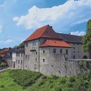
The route follows the course of the stream past the Wiebesiek barbecue area to Kalldorf. Here, the former Engelsmeierschen Hof farmhouse at the mill pond is not only a stately solid stone building dating back to 1889, but also a historic bakery, a toilet block for hikers and various seating areas in the grounds that invite you to linger. The route leads past the Ziegler monument through Kalldorfer Holz to the Weser village of Erder. The route continues on a flat stretch parallel to the Weser towards the Herrengraben nature reserve. Along the way, information steles point out historical and scenic features. At Herrengraben in the front Weser floodplain, the historic four-arch bridge dating from 1753 provides information about the original course of the Weser. The stage destination is the castle complex and Varenholz, which with its picturesque inner courtyard is one of the most beautiful buildings of the Weser Renaissance.
Start: Gutshof Hankenegge (junction of Vlothoer Straße / Hankenegge, Kalletal)
Stage 4, length 12.7 km
Varenholz to Silixen
The stage starts below the small castle church up to the Kirchberg. Above the Peilesiedlung settlement on the edge of the Langenholzhausen forest, a panoramic view opens up to the north of the Weser valley and Stemmer See lake. Before the route continues south through the forest in Elfenborn, the Lippische Alleentor with rest and information point greets you at the border with Lower Saxony on the B238. Past the "Zweiländereck", another vantage point with a rest area awaits at the "Lange Wand". In Heidelbecker Holz, the Trail of Views leaves the municipality of Kalletal at Potsdamer Platz and leads through beautiful woodland to Silixen.
Start: Varenholz information board (Beutebrink 6, Kalletal)
Stage 5, length 8.2 km
Silixen to Rickbruch
This stage offers fantastic panoramic views of the Weserbergland with Porta Westfalica and Schaumburg along fields and meadows. At the Rickbruch estate, you cross the River Exter at one of its most beautiful spots.
Start: Information board at the Silixen farm (junction of Heidelbecker Straße / Im Graben, Extertal)
Stage 6, length 28.4 km
Rickbruch to Sonneborn
On this route, you cross the border between North Rhine-Westphalia and Lower Saxony several times. You have a magnificent panoramic view from the viewing tower on the Hohe Asch. The route continues through various nature reserves to Sonneborn.
Start: Info board at the hiking parking lot at Gut Rickbruch
Stage 7, length 19.1 km
Sonneborn to Sommersell
This route takes you through fields and forests to Sommersell. In the picturesque village center, natural stone walls line restored farms and houses. From here, the view extends as far as the windmill stump on the Saalberg.
Start: Sonneborn information board at the church (Hauptstraße 68, Barntrup-Sonneborn)
Stage 8, length 13.6 km
Sommersell to Dörentrup
This stage takes you along beautiful forest paths as well as fields and meadows past the Wendlinghausen energy village with an information point at the biogas and photovoltaic plant. The view extends as far as Sternberg Castle, which towers over the Bega Valley.
Start: Sommersell shelter and barbecue hut (Im Lied, Barntrup-Sommersell)
Stage 9, length 12.8 km
Dörentrup to Linderhofe car park
On its final stage, the Trail of Views leads you along idyllic forest paths through hollow paths and semi-natural deciduous forests. A number of lovingly restored half-timbered houses along the way are reminders of times gone by.
Start: Dörentrup information board (junction of Lemgoer Straße / Zum Netling, Dörentrup)
Good to know
Best to visit
suitable
Depends on weather
More information
www.wanderregion-nordlippe.de
Contact person
Lippe Tourismus & Marketing GmbH
Mr. Jan Wisomiersky
Grotenburg 52
32760 Detmold
Author
Lippe Tourismus & Marketing GmbH
Herr Jan Wisomiersky
Grotenburg 52
32760 Detmold
License (master data)
Lippe Tourism & Marketing GmbH
Nearby


