- Photos & Map
How would you like to arrive?
- Call
- Description
- Good to know
- Nearby
Download GPX file
- 2:15 h
- 6.28 km
- 96 m
- 86 m
- 157 m
- 243 m
- 86 m
- Start: Parking lot in front of the church in Bellersen
- Destination: Parking lot in front of the church in Bellersen
The trail takes you 6 km through Bellersen and the area south of Bellersen. Here you can explore the village, meadows, fields and forests. Along a scenic route, you will experience impressive nature and gain insights into the history of agriculture and forestry. At the individual stations, information boards will familiarise you with the historical facts.
The following stations and topics await you:
1. overview map:At the starting point in the centre of Bellersen village, you can find out about the route of the trail.
2. Mühlengraben and Bleiche:
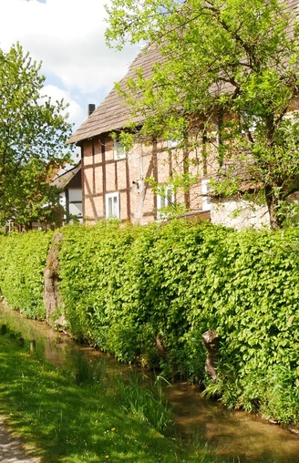
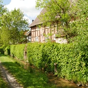
The artificially created Mühlengraben branches off from the Bruchte stream at this point, which flows through Bellersen and drives a mill wheel south of the village. The meadow between Bruchte and the mill race used to be used by the villagers to bleach the linen, most of which they produced themselves.
3rd mill:
A grain mill was in operation here from the Middle Ages until 1965. The mill wheel still turns.
4. Former gardens at Rammelsberg:
A few hedges and terraced edges are the last visible evidence of a large number of small vegetable gardens, some of which were cultivated here near the village until the 20th century to supplement the insufficient home gardens.
5. Heck cattle "Aurochs":
The ancestors of our domestic cattle are increasingly being used again for nature conservation and landscape management on land that can hardly be utilised profitably in modern agriculture.
6. Rafting meadows in the Bruchtetal:
In 1893/94, a rafting facility was built in the meadow valley below the village. Two weirs are used to dam the water of the stream and channel it through the rafting ditches across the meadows to encourage grass growth. The weirs and some sections of the rafting ditches of the now abandoned facility still exist and illustrate how it worked.
7. village site Hemmenhusen, old country road at Süsterfeld and former glassworks Sengenthal:
The village of Hemmenhusen was located here from the 9th to the 13th century. The current field name "Süsterfeld" (sister field) preserves the memory of old legal relationships, as the monastery in the village of Gehrden received taxes from the Hemmenhusen fields. A remnant of a hollow path is the relic of a medieval long-distance path used until the 19th century. To the south of the Süsterfeld, the former Sengenthal forester's lodge marks the site of a forest glassworks.
8. Fruit tree plantations on the Schmandberg:
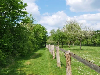
A large meadow orchard is the still impressive and ecologically valuable remnant of a fruit tree plantation established in 1892, which ultimately comprised 3,200 fruit trees of different varieties over an area of 272 hectares. Due to unfavourable soil conditions, however, most of the plantation has been abandoned.
9th Schmandberg viewpoint:
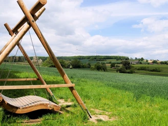
From the top of the Schmandberg, you have a sweeping view of the Bruchtetal valley as far as the town of Brakel. The location of the Hinnenburg castle on a mountain spur above the valley is also remarkable.
10. Hude and forest property:
In the past, the Schmandberg served the village of Bellersen as a communal pasture for a long time. The herding of cattle, pigs, goats and sheep in the fields, wastelands and forests by shepherds was the basis of livestock farming until the 19th century. A map shows who owned the forests around Bellersen at that time.
11. Forest development and forest utilisation:
The forest area around Bellersen reached its smallest extent at the beginning of the 19th century. Since then, the forest area has increased significantly. The quality of the forest has been sustainably improved through targeted forest management. The latter is only possible because the use of the forest for farming purposes, which was common for centuries - mainly as pasture in the 19th century - has come to an end.
12th Fahlenkämpen viewpoint - geology and landscape:
The location of the viewpoint on the edge of the forest provides a good overview of the northern edge of the Brakel shell limestone sill and the south of the Lippe Keuperbergland. The geological structure of the landscape is shown on a panel.
13. The change in agriculture:
The basis for modern agriculture was created in the 19th century. The legal and economic relationships that had been tried and tested for centuries but prevented the introduction of effective agricultural methods were ended. A comparison of the former and current forest and field boundaries shows how this also changed the shape of the land.
14. The development of the village of Bellersen:
Once you have reached the Strickberg, the village of Bellersen lies before you. A map shows how the village has taken on its current form in various stages of development since it was founded around 800 BC.
Good to know
Pavements
Best to visit
Tour information
Cultural Interesting
Familiy-Friendly
Loop Road
Possibility of Accommodation
Stop at an Inn
Suitable for Winter
Tour with Dog
Directions & Parking facilities
Bus route 585 (as of Nov. 2021)
Additional information
werkhaus@bellersen.de
Tourist Information Bellersen (+49 5276 / 7202)
tourist-info@brakel.de
Contact person
Stadt Brakel
Author
Tourist Information Brakel
Organization
Stadt Brakel / Fachbereich 2 / Tourismus
License (master data)
Tourist Information Brakel
Nearby
