


- 3:26 h
- 11.52 km
- 305 m
- 305 m
- 254 m
- 422 m
- 168 m
- Start: Lichtenau-Blankenrode, Altenauquelle parking lot (Hardehauser Straße)
- Destination: Lichtenau-Blankenrode, Altenauquelle parking lot
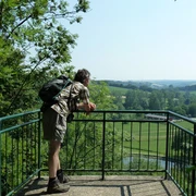
Where the gamekeeper Hermann Klostermann was up to mischief in the 19th century, today it is a wonderful place to hike. Thanks to many sections in shady forests, this trail is also suitable for a hike on warm summer days.
Soon after the start, you will reach the Bleikuhlen near Blankenrode, where the Galmei violet, unique in Europe, grows. The purple flowers provide a beautiful splash of color in the landscape.
Another attraction is the former castle town of Blankenrode, which was destroyed in 1390 and fell into ruin. Walls and ditches are still visible in the forest today. The innovative Blankenrode audio museum brings history back to life here in an exciting and child-friendly way.
Good to know
Pavements
Best to visit
Directions
Further along, the A1 leads you down through the Schwarzbach valley and then up along the Klingelbach stream. You pass the Warburger Hütte and the soldiers' graves. Southeast of the Humbertsberg, follow the path around to the right. After a few meters, the A1 turns left into a small path. The path ends below the Blankenrode ruins and you reach the A2, which you follow in an easterly direction from here.
After a while, you pass the Teipelskreuz cross and soon the trail descends sharply. Once in the valley, follow the A2, which meets the Sintfeld Höhenweg here, uphill along the Blankenroder Bach stream. After a while, you reach the signpost for Papengrund, which you pass. A few meters after the signpost, the path leads off to the left and we follow the path into the forest. Here you meet the A7, which you now follow.
You reach the district road. From here, the path runs parallel to the road for a while until you reach the hiking parking lot at the Hörmuseum. Cross the road at the parking lot and follow the A1 again from here. You will pass the Blankenroder Hütte and soon reach your starting point in the town center.
Tour information
Loop Road
Nature Highlight
Equipment
Directions & Parking facilities
An alternative parking option is the hiking parking lot at the Hörmuseum on the outskirts of Blankenrode (Blankenroder Straße in the direction of Hardehausen) or the hiking parking lot at the Bleikuhlen.
(20 cents/connection from landlines and a maximum of 60 cents/connection from mobile networks.)
Contact person
Author
Kreis Paderborn | Wirtschaft & Tourismus
License (master data)

Author´s Tip / Recommendation of the author
Safety guidelines
Map
Nearby

