- 6:30 h
- 19.46 km
- 276 m
- 326 m
- 272 m
- 426 m
- 154 m
- Start: Willebadessen, transmission tower
- Destination: Lichtenau-Blankenrode
The stage at a glance:
- Short stage route
The starting point for this stage is Willebadessen railroad station. From here, you hike along the access path towards the telecommunications tower up to the Egge. The Eggeweg leads you along the ridge to the "Kleiner Herrgott" - the remains of a stone monument. The trail then leads above the rugged sandstone cliffs of the Teutonia Klippen through a beech forest. Passing the sea of cliffs and rocks, you reach the summit of the "Nadel" - a mountain peak - via a steep path into the Schwarzbachtal valley, a European nature reserve. On the rest of the stage, you reach the medieval ruins of Blankenrode. Stage 12 of the Hermannshöhen hiking trail ends in Blankenrode. - Length of the stage in kilometers / altitude difference / route character
The stage is 19 kilometers long and has an altitude difference of 270 metres. It is moderately difficult and suitable for experienced hikers. - Scenic features
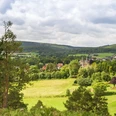
Rugged rocky slopes, dark waters, a bird sanctuary, romantic gorges, beautiful views of the Teutoburg Forest/Eggegebirge Nature Park landscape and impressive rock formations, beech forests and semi-natural deciduous forests await you on this stage. With a bit of luck, you may spot the resident black stork in the bird sanctuary. There are numerous spring outlets surrounded by lush herbaceous vegetation such as ferns, horsetails and sour grasses, streams and diverse vegetation. At the Teutonia cliffs you can see collapsed tunnels, pits, slag heaps and pings as evidence of the iron industry. In the "Bleikuhlen" nature reserve, you can discover the blue to purple-flowered galmei violet, an endemic species that only occurs here in Europe.
Highlights on the route
- The Gorge of the "Old Railway": a natural monument with rugged cliffs and dark waters. The gorge was created by earlier tunnel constructions. However, these were discontinued due to water ingress and difficulties in constructing the route. An educational trail from the Teutoburg Forest/Eggegebirge Nature Park provides information about the events surrounding this historic construction site. There is also another listening station here, where Anna & Hermann, a senior citizen with local knowledge and his granddaughter, reveal details about the historic construction site.
- The Teutonia Cliffs are an impressive natural spectacle. This is the site of an abandoned iron ore mine, where collapsed tunnels, pits, slag heaps and sinkholes are reminders of the iron industry. Did you know? The area was named after the Teutonia Society bought up the forest.
- The former Hardehausen Monastery was founded by Cistercian monks in 1140, making it the oldest Cistercian monastery in Westphalia.
- The Bison enclosure at the Hammerhof forest information center near Warburg-Scherfede is a show enclosure for bison and other wild animals. A new observation tower provides views and insights into the enclosure.
- The medieval town fortress of Blankenrode is a border fortress built in the middle of the 13th century AD by the Prince-Bishop of Paderborn on the mountain spur of the Egge. Although the town was completely destroyed in 1390, scattered remains of ramparts, ditches and walls are still visible today and bear witness to the town's former existence. Family tip: There is an audio museum in the deserted town, where Agnes and Konrad, two children from the old town of Blankenrode, take visitors on a special journey of discovery. In this way, the medieval town is brought back to life.
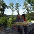
You can find a good alternative interactive tour map of the stage here
Good to know
Pavements
Best to visit
Directions
You will find this quality establishment in Hermannshöhen along the way:
Willebadessen
- Avenarius Wohlfühlhotel DER JÄGERHOF, www.jaegerhof-willebadessen.de, Tel. 05646 - 8010
Tour information
Nature Highlight
Possibility of Accommodation
Premium Trail "Wanderbares Deutschland"
Tour with Dog
Directions & Parking facilities
Parkplatz Bahnhof Willebadessen
Am Bahnhof 1,
34439 Willebadessen
Bahnhof Willebadessen
Information about the train stationParking lot Alte Eisenbahn
L763, 34439 Willebadessen direction Kleinenberg
directly on the way
No connection to local transport available!!Parking along the way:
Parking lot Grunewald
Hauptstr. 80,
33165 Lichtenau
approx. 50 m to path
Bus stopKleinenberg, GrunewaldS85 Paderbron - Warburg
FahrplanauskunftParkplatz Grunewald
Hardehauser Straße,
33165 Lichtenau
Bus stopLichtenau-Blankenrode
479 Lichtenau - Blankenrode (restricted)Detailed information about your journey by bus and train can be found here.
The smart number for bus and train in NRW:
08006 - 50 40 30 (free from the German landline network).
.
Additional information
Author
Ina Bohlken
Organization
Projektbüro Hermannshöhen
License (master data)

Safety guidelines
A total of 28 rescue points have been created on the Eggeweg. They are used to indicate the location as precisely as possible in the event of danger so that the rescue station can find the scene of the accident promptly and reliably.
The following rescue points are registered with the emergency call center on this section:Alte Eisenbahn- Hütte, Krollhütte, Borlinghauser Hütte, Bördeweg Nadel, Roters Eiche Hütte, Mittelwald Hütte, Blankenroder Hütte
Nearby