- 42:00 h
- 145.75 km
- 1,950 m
- 1,950 m
- 174 m
- 447 m
- 273 m
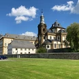
- Start: Jesuit Church (Burgstraße, Büren)
- Destination: Büren
The 144 km hiking trail can be divided into 6 daily stages and is suitable for keen hikers thanks to its moderate gradients.
Wide views across the karst plateau with its fields and alluvial valleys are just as stimulating for the senses as the fresh scent of forests and heaths. If you look closely, you can discover exciting geological phenomena such as the shrinking of streams. Small watercourses, such as the lively River Alme, seep into the ground at significant points, only to reappear elsewhere.
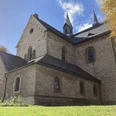
The countless insights into the eventful past are also exciting along the way: Stone cists and burial mounds, ruins, churches and monasteries turn the hike on the Sintfeld High Trail into a historical journey through time.
Numerous cafés, restaurants and inns along the way also make the hike an encounter with genuine Westphalian hospitality and delicious, down-to-earth cuisine.
Good to know
Pavements
Best to visit
Directions
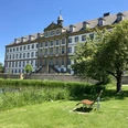
Route: Büren - Wewelsburg - Dalheim Monastery - Herbram-Wald - Blankenrode - Bad Wünnenberg - Ringelstein - Büren
Route markings
Tour information
Loop Road
Possibility of Accommodation
Stop at an Inn
Equipment
Directions & Parking facilities
Lichtenau / Kloster Dalheim exit Marsberg - Meerhof (A 44)
Bad Wünnenberg junction Bad Wünnenberg - Haaren (A 33 / A 44);
Büren exit Büren (A 44)
Always know what's running: The smart number for buses and trains in NRW 01803 504030 (timetable information for €0.09/min from a German landline, mobile max. €0.42/min).
Additional information
Contact person
Author
Kreis Paderborn | Wirtschaft & Tourismus
License (master data)

Author´s Tip / Recommendation of the author
Safety guidelines
- not suitable for pushchairs
- not suitable for wheelchair users
Map
Social Media
Nearby