- Photos & Map
How would you like to arrive?
- Description
- Good to know
- Nearby
Download GPX file
- 1:45 h
- 13.75 km
- 126 m
- 128 m
- 257 m
- 349 m
- 92 m
- Start: KuGA Bad Wünnenberg, Im Aatal 1
- Destination: KuGA Bad Wünnenberg, Im Aatal 1
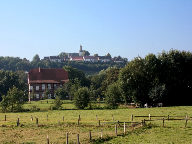
The cycle paths around Bad Wünnenberg are marked with red and white NRW cycle signs (labeled WÜ =Bad Wünnenberg 1 to 8) and vary in length from 9 km to 25.1 km. They lead partly through meadows and fields, but also through forests around Bad Wünnenberg. Most of them are asphalted and therefore easy to cycle on.
The WÜ 2 cycle route has a length of 13.8 km. It starts and ends at the KuGA (Kneipp and Health in the Aatal) in Bad Wünnenberg. The route is also suitable for inexperienced cyclists. From Bad Wünnenberg you first come to the village of Leiberg. The road "Hohler Weg" is a section where you may have to push your bike. Bishops, counts and robber barons fought over the village of Leiberg in the Middle Ages. It was borderland between Franconia and Saxony, between the Duchy of Westphalia and the Prince-Bishopric of Paderborn.From Leiberg, the route takes you to the Sintfeld, where you will find yourself on a historic trade route, the Königsweg "Hirschweg", along which merchants traveled in the Middle Ages. Above the village of Leiberg, let your gaze wander into the distance and enjoy the wonderful view, the sun and the wind. From the Paderborn plateau, cycle back to the town of Bad Wünnenberg. Here, at the end of the tour, you can visit the Aatal nature experience with its wide range of activities. Offers such as the Aatal adventure park, the adventure barefoot trail or the game reserve invite you to enjoy further activities.
Good to know
Best to visit
Directions
The tour is 13.8 km long and starts at the KuGA (Kneipp and Health in the Aatal) in Bad Wünnenberg.In the Aatal, you start heading north, turn left on Mittelstraße, cross the traffic lights into Schützenstraße and later into the street "Auf dem Rügge". You then cycle through the Bad Wünnenberg fields along the small river "Afte" to Leiberg. Here you are also on the Auenradweg cycle path for a while. Take the Nollenweg to the right, cross the L 549 and then turn right up the "Hohler Weg" road. At the top, turn right onto the K34 to get out of Leiberg. You pass the "Drei Linden", a natural monument, and 1 km later turn right onto the "Hirschweg". Pass under the B 480, cross the L 651 immediately afterwards and turn right onto the next paved country lane. Turn left at the next opportunity and then turn right again at the next dirt road. Here the road climbs significantly for a short distance. Follow the path and you will reach Zinsdorfer Weg, which takes you back into the town of Bad Wünnenberg. From Rosenstraße, turn left again, cross Mittelstraße and return to your starting point at the KuGA.
Tour information
Familiy-Friendly
Loop Road
Equipment
Directions & Parking facilities
A44 Dortmund-Kassel, junction Bad Wünnenberg-Haaren, then continue on the B480 towards Bad Wünnenberg. In the town, turn left at the traffic lights into Mittelstraße. Then take the second entrance on the right into "Im Aatal"
.A33 Bielefeld/Brilon, exit at the Bad Wünnenberg-Haaren junction, then continue on the B480 towards Bad Wünnenberg. In the town, turn left at the traffic lights into Mittelstraße. Then take the second entrance on the right into "Im Aatal".
Take the train to Paderborn main station; from there take the bus in the direction of Bad Wünnenberg, bus route R11 stop Kurhaus or regional bus R10 (until 06.07.21: S10) stop Schäferstraße.
For more information about traveling by bus, please visit www.fahr-mit.de or call: 05251/2930400
Additional information
Further information and GPS devices are available from Bad Wünnenberg Touristik GmbH at:
Author
Kneippheilbad Bad Wünnenberg
Organization
Bad Wünnenberg Touristik GmbH
License (master data)
Author´s Tip / Recommendation of the author
Nearby
