BE 3 - Around Bad Essen


- 2:50 h
- 41.89 km
- 228 m
- 222 m
- 43 m
- 162 m
- 119 m
- Start: Touristinfo Lindenstraße
- Destination: Touristinfo Lindenstraße
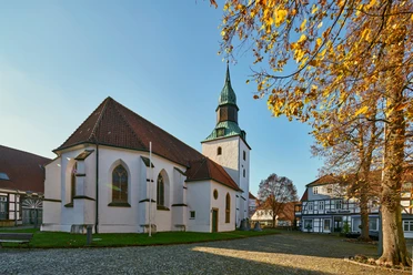
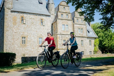
The start of the circular route is at the Tourist Information on Lindenstraße. You will get to know Bad Essen with all its advantages: somewhat "mountainous" on the southern route through the deciduous forests of the Wiehengebirge past the dinosaur tracks, and in the northern area rather flat past Wittlage Castle and the Ippenburg and Hünnefeld castles.


Good to know
Pavements
Street (12%)
Asphalt (56%)
Gravel (28%)
Trail (3%)
Path (1%)
Best to visit
suitable
Depends on weather
Tour information
Barrier-Free
Cultural Interesting
Loop Road
Stop at an Inn
Author
Natur- und Geopark TERRA.vita
Organization
Osnabrücker Land
License (master data)
Tourismusgesellschaft Osnabrücker Land mbH

Map
Bike map Bad Essen, Bohmte, Ostercappeln, available at the Tourist Information Bad Essen and the municipalities of Bohmte and Ostercappeln
Nearby


Download GPX file