


- 1:18 h
- 20.56 km
- 18 m
- 19 m
- 39 m
- 52 m
- 13 m
- Start: Parking lot at the recreational meadow, Zur Römerbrücke (42 m) Coordinates: Geogr. 52.440093 N 8.289690 E UTM 32U 451716 5810225
- Destination: Parking lot at the recreational meadow, Zur Römerbrücke (42 m) Coordinates: Geogr. 52.440093 N 8.289690 E UTM 32U 451716 5810225
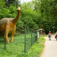
Get to know our diverse community while cycling around Bohmte, Hunteburg, and Herringhausen-Stirpe-Oelingen in a wonderful landscape with extensive fields, forest, and moorland. Enjoy our cultural offerings, the good gastronomy, and feel invited to join our festivals.
The varied but mostly flat landscape invites every cyclist and also hikers. This charm could not escape Wilhelm Busch, who was a guest in Hunteburg several times between 1894 and 1898. He liked it so much that he wrote to a friend on his first visit: “It was quite a pleasant area where I stayed the last days, in addition with nice weather. Isolated farmsteads; whitewashed; fresh green rye fields all around; in the distance a range of blue hills …..” A quiet and relaxing landscape, ideal for hiking, cycling, unwinding, and enjoying, is offered by Bohmte in the Osnabrück region.
Good to know
Pavements
Street
Asphalt
Gravel
Trail
Best to visit
suitable
Depends on weather
Tour information
Barrier-Free
Cultural Interesting
Familiy-Friendly
Loop Road
Stop at an Inn
Author
Natur- und Geopark TERRA.vita
Organization
Osnabrücker Land
License (master data)
Tourismusgesellschaft Osnabrücker Land mbH

Map
Cycle map Bad Essen, Bohmte, Ostercappeln, available at the Tourist Information Bad Essen and the communities of Bohmte and Ostercappeln
Nearby
