Circular route "Neue Landschaft® Ronneburg" - Elstersteigen 4


- 2:30 h
- 9.50 km
- 117 m
- 117 m
- 241 m
- 336 m
- 95 m
- Start: Parking lot on Grobsdorfer Straße
- Destination: Parking lot on Grobsdorfer Straße
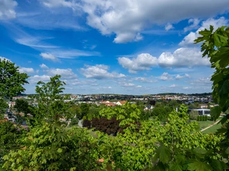
The transformation from a mining landscape to a landscape park was an attraction for insiders and the curious. Tourist highlights include the Drachenschwanz Bridge, Discovery Tower, exhibitions, climate experience trail, themed playgrounds, miniature mining towers, event area, and the Schmirchauer Höhe with a walkable map.
The "Elstersteigen" project is a new hiking project that creates new circular routes on the existing hiking network. The circular hiking trails are continuously developed to offer a high-quality hiking experience.
Waypoints
Start

Destination
Good to know
Pavements
Asphalt (29%)
Gravel (28%)
Trail (33%)
Path (10%)
Best to visit
suitable
Depends on weather
Tour information
Loop Road
Loop Road
Author
Vogtland - Sinfonie der Natur
Organization
Vogtland - Sinfonie der Natur
License (master data)
Vogtland - Sinfonie der Natur

Nearby


Download GPX file