Circular route via Backofenfelsen and Opitzhöhe to Tharandt


- 4:00 h
- 11.79 km
- 357 m
- 357 m
- 190 m
- 368 m
- 178 m
- Start: Hainsberg-West S-Bahn station
- Destination: Hainsberg-West S-Bahn station
The trail leads over the striking Backofenfelsen rock. The geological natural monument shows an outcrop of the Rotliegend sedimentary series. From its plateau, you have an impressive view over the Weißeritz Valley between Tharandt and Freital and the ascent to the lower Eastern Erzgebirge.The route continues to the Opitzhöhe, which is geologically the north-easternmost elevation in the Ore Mountains and offers an excellent view of the Elbe valley and the edge of the Ore Mountains with Quohrener Kipse, Wilisch and the striking Luchberg. With good visibility, you can also see the Geising and Kahleberg mountains as well as the table mountains of the Elbe Sandstone Mountains. After descending to the forestry town of Tharandt, the return route leads back to the starting point via the adventurous Brüderweg trail on the southern steep slope of the Weißeritz valley.
Good to know
Pavements
Best to visit
Directions
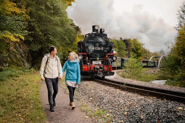
Our 10.5-kilometre hike is marked no. 3. It starts at the Hainsberg-West S-Bahn station or opposite the road at Heilsberger Park. From here, we walk to the southern steep slope of the Weißeritz valley and follow the "Grüner Strich" hiking sign behind the bus stop up towards Opitzer Höhe. After approx. 1.3 kilometers we reach our first sight, the Backofenfelsen. The Backofenfelsen, which geologically no longer belongs to the Ore Mountains, towers about 50 meters above the Weißeritz valley floor near Hainsberg. Several benches invite you to linger. The Backofenfelsen is a natural geological monument whose rock is dominated by Rotliegendes and a conglomerate of porphyry and granite. The caves in the rock were formed by erosion and weathering. As early as 1752, the cave by the road was referred to as a "baking oven".
From here, we continue along the Förster-Claus-Weg to the Opitzhöhe, which offers a beautiful panoramic view. Since 1995, a wind turbine on the Opitzhöhe has been a clear landmark. The main "Grüner Strich" hiking trail continues to the right in the direction of Weißig and Pesterwitz. We follow no. 3 to the left along a field path towards Tharandt. This continues to offer beautiful views in all directions. At some point, we see a sign to Johannishöhe on the left of the path. However, we continue along Hohe Straße, marked no. 3, past a garden plot and on to Opitzer Weg into the valley. Almost at the bottom, we turn left into the street An der Schmiede, which we follow to the church. Then continue along Roßmäßler Straße to the market square. There are public toilets at the town hall. The small town, first mentioned in 1216, has a striking viewpoint over the town with its medieval castle complex. There are several places to stop for refreshments here in Tharandt.
From the town hall, we walk left along the Schloitzbach stream. On the right-hand side we see a net parking lot. Opposite, on the left-hand side of the road, the Brüderweg begins, leading uphill into the forest. Caution! Some parts of the path are exposed, and due to the steepness of the slope, parts of the path are often buried or break off, so surefootedness is required. The Brüderweg is no longer an official hiking trail. It is partly secured with iron ropes. Every now and then you have to cross a stream. Nevertheless, the path high up on the slope is highly recommended due to the beautiful natural surroundings. When we reach the hiking signs, we see that we were already here at the start of our hike and walk back to the starting point.
Tour information
Loop Road
Stop at an Inn
Equipment
sturdy shoes
Directions & Parking facilities
- Coming from Dresden or the A17 highway, cross Freital in the direction of Tharandt. Shortly before leaving the town, turn left into Somsdorfer Straße and look for a parking space.
- Coming from Tharandt, turn right into Somsdorfer Straße immediately after entering the town and look for a parking space.
- Some free parking facilities near the starting point
- Large free parking lot for hikers at the Weißeritzpark above the railroad tracks (approx. 5 minutes' walk)
- S-Bahn S3 from Dresden main station or from Tharandt to Freital Hainsberg-West stop
- Regional train RB 30 / regional express RE 3 to Freital-Hainsberg or Tharandt S-Bahn station, from there continue by S-Bahn (one stop each way) or by bus 344, 345, 363
- City bus line 160 (Dresden Löbtau - Freital) to the Coßmansdorf stop (3-minute walk to the starting point)
- Regional bus lines 344,345,363 to the Freital Hainsberg-West stop
Additional information
Author
Tilo Harder
Organization
Dresden Elbland
License (master data)
Tilo Harder

Author´s Tip / Recommendation of the author
In Tharand you can visit the old mountain church, the castle ruins or the forest botanical garden.
Safety guidelines
The Brüderweg is no longer an official hiking trail. Some parts of the trail are very narrow. Due to the steepness of the slope, parts of the path are often buried or break off. Surefootedness is absolutely essential and rocky passages are sometimes secured with iron ropes. Every now and then you have to cross a stream.
Nearby


Download GPX file