- Photos & Map
How would you like to arrive?
- Description
- Good to know
- Nearby
Download GPX file
- 5:00 h
- 14.00 km
- 27 m
- 26 m
- 110 m
- 136 m
- 26 m
- Start: Parking lot at the Krollbach bifurcation
- Destination: Parking lot at the Krollbach bifurcation
Harmoniously integrated into the Senneland landscape at the foot of the Teutoburg Forest, the densely wooded Senne municipality invites you to get to know this impressive natural and cultural landscape "on foot".
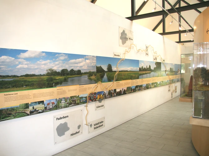
In the Moosheide nature reserve, the original alpine pasture landscape with its picturesque stream valleys, dunes and heathland vegetation is still intact. The Ems also has its source here in the Moosheide, the upper headwaters of which belong to the town of Schloß Holte-Stukenbrock. After 371 kilometers, the Ems flows into the North Sea near Emden. The Ems Info Center is located in the immediate vicinity of the Ems springs and directly on the Ems springs hiking trail, providing a wealth of information about the regions along the Ems and interactive elements to try out.
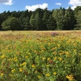
Before you reach the Moosheide nature reserve, the hiking trail first leads through Hövelhofer Forst and Hasendorf to the Ems Info Center. The highlight of the hiking trail is the Moosheide nature reserve. Especially in August, when the heath is in full bloom, the area is transformed into a scenic gem.Other highlights along the way:
Krollbach bifurcation:
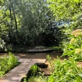
The bifurcation is the official starting point of the hiking trail. The term refers to the rare bifurcation of a watercourse where the water is divided between two river systems. This is exactly what visitors can experience at the Krollbach bifurcation. The actual Krollbach reaches the western North Sea after 480 km via Haustenbach, Lippe and Rhine, while the Schwarzwasserbach reaches the central North Sea after 440 km via Hallerbach and Ems. The area around the bifurcation was recently redesigned. The rainwater retention basin can be crossed via the embankment and, depending on the wind force, can sometimes create a maritime feeling.
Wildlife enclosure of the Senner horses:
Semi-wild horses have grazed in the Senne since the 12th century. The semi-wild husbandry gave the horses their resilience, endurance, frugality, hardiness and fertility. Only with great effort have dedicated breeders managed to save some animals of this endangered horse breed to this day. The Paderborn/Senne District Biological Station has set itself the task of enabling Senner horses to return to their original habitat. In 2000, the horses were therefore given a 15-hectare wild area in the Senne. With a bit of luck, the horses can be spotted here.
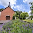
Heidschnuckenschäferei Senne:On the edge of the Senne military training area is the Senne Heidschnucken sheep farm run by the Paderborn/Senne District Biological Station. The sheep farm is housed in two buildings (sheepfold and hay store) belonging to the Nordrhein-Westaflen-Stiftung für Naturschutz, Heimat- und Kulturpflege. It is home to a herd of around 1000 gray horned heather sheep. The herd also includes around 30 goats. They graze the heathland and sandy grasslands in the Senne all year round, helping to preserve the old Westphalian heathland. Continuous browsing prevents the heather from ageing. The sheep thus keep the heathland free of emerging trees and shrubs. At lambing time in March, the ewes and their newborn lambs can be found in the barn for a short time. Heidschnucken specialties can also be purchased in the farm store. The sheep farm is accessible at all times, but there may be no Heidschnucken to be seen. Guided tours can be requested at the sheep farm:
Heidschnuckenschäferei Senne
Sennestraße 233
33161 Hövelhof
Tel: 05257 6933 (please leave a message on the answering machine)
Email: schaeferei@bs-paderborn-senne.de
Sales hours of the farm store:
Thursday afternoon: 15:00 to 19:00
Friday morning: 9:00 to 12:00
Or at any time on advance order
Good to know
Pavements
Best to visit
Directions
Description of the feeder route:
The route of the Emsquellen hiking trail officially starts at the parking lot at the Krollbach bifurcation. As Hövelhof is conveniently located between Paderborn and Bielefeld, we recommend traveling by train. From Hövelhof station, a 1 km long feeder road leads to the starting point. The feeder route has the same route logo as the main route and is marked "Zuweg". From the platform, leave Bahnhofstraße to the south in the direction of Allee. At the end of the street, turn left into Allee and then cross the railroad tracks directly to reach Sennestraße. Continue straight ahead past the photo studio. After the junction with Jägerstraße, cross Sennestraße and continue in the same direction. Shortly after the turning loop at the school center, you will reach the Krollbach bifurcation. Cross the road again here to reach the parking lot. This is the official start of the hiking trail.
From the starting point of the tour, the Krollbach bifurcation, turn left onto Kastanienweg - after the right-hand bend, turn left onto Ebenweg and immediately left again onto Birkenweg. Next, turn right into the street "Hermann-Löns-Platz" and then past the Jägerkreuz onto Jägerstraße - cross the street to enter the forest. Follow the signs through the forest until you leave it again and turn left onto Emser-Kirchweg. At the next opportunity, turn right onto Moosweg - this is followed by a short left-right-left combination before you reach "Untere Bielefelder Landstraße". Turn left into the road. After about 1 km, turn right into the forest, then immediately left and right again into Steinweg. At the next opportunity, turn left again to stay on "Steinweg". Follow the signs to the right into the forest. Follow the signs from here. On this section you have a good view of the Emstal valley. At the end, turn left onto Emser Kirchweg and then right again to reach the parking lot of the Ems Information Center. Continue straight ahead until you reach the Ems springs. On this section, you will first pass the Ems Information Center and then the Senner Pferde game reserve. Once you arrive at the Ems springs, follow the signs until you reach the "Steinweg" again. From here, follow the signs to the Sandfangteich parking lot - leave the parking lot and turn left onto Moosheider Straße. If you wish, you can take a detour from here to the Senne Heidschnucken sheep farm. To do this, follow the road to the end and turn left. The Heidschnucken sheep farm is located opposite the Hövelsenn Chapel. The regular route leads from Moosheider Straße to the right into "Hasendorfweg" - then left into Am Wasserstrang - right into Mühlenschulweg - then half left onto Hollandsweg. Continue straight on to Kastanienweg and back to the starting point of the hike, the parking lot at the bifurcation.
Tour information
Loop Road
Stop at an Inn
Directions & Parking facilities
Journey to the station (feeder road)
From Paderborn, take exit 24 Paderborn-Sennelager on the A 33 and turn right towards Hövelhof. In Hövelhof, cross the large main intersection in the town center. Then turn right at the town hall into Bahnhofstraße. Coming from Bielefeld, leave the A33 at exit 23 Stukenbrock-Senne. Drive straight on through the traffic circle and turn left after the pedestrian lights into Bahnhofstraße.
You are now driving directly towards the train station. From the station, an approximately 1 km long feeder road leads directly to the Krollbach bifurcation, the starting point of the Emsquellen hiking trail.
Note: Please note that there are currently roadworks on the route of the feeder road. Further information can be found under "Directions".
How to get to the starting point
From Paderborn, take exit 24 Paderborn-Sennelager on the A 33 and turn right towards Hövelhof. In Hövelhof, turn right at the main crossroads in the town center, cross the railroad tracks and follow Sennestraße. Turn left into Kastanienweg and then immediately left again into the parking lot.
From the direction of Bielefeld, leave the A33 at exit 23 Stukenbrock-Senne. In Hövelhof, turn left at the main crossroads in the town center, cross the railroad tracks and follow Sennestraße. Turn left into Kastanienweg and then immediately left again into the parking lot.
Nahverkehrsverbund Paderborn/Höxter
Always know what's running: The smart number for buses and trains in NRW 01803 504030 (timetable information for €0.09/min from a German landline, mobile max. €0.42/min)
Additional information
Tourist Information Hövelhof
Schloßstraße 11
33161 Hövelhof
Tel.: 05257 5009-860
Fax: 05257 5009-869
tourismus@hoevelhof.de
www.hoevelhof.de
Author
Gemeinde Hövelhof
Organization
Tourist-Information der Sennegemeinde Hövelhof
License (master data)
Author´s Tip / Recommendation of the author
A visit to the Ems Information Center is always worthwhile. Here you can find detailed information about Germany's shortest river and the regions to the right and left of it. The interactive models are a particular highlight. For example, you can let the springs of the Ems spring up for yourself or let a cruise ship from the Meyer pass through the eye of the needle at the Ems barrier.
Opening times
Open daily
April - September 9.00 - 20.00
October - March 10.00 - 17.00
- Free admission, barrier-free site
- Free parking spaces
- Public, barrier-free toilets with drinking water dispensers
Only a stone's throw away from the starting point of the hike is the OWL Home Center
.A visit here is definitely worthwhile, as the Plattdeutscher Kreis Hövelhof (Low German Circle Hövelhof) operates in a farmhouse built around 1900 and in the House of Historic Crafts (built in 2005) and maintains traditional rural crafts such as ropemaking, basket weaving, broom making, spinning, weaving, farmhouse bread and butter making on a voluntary basis. The entire complex comprises five buildings, the Heimathaus itself, the bakehouse, the barn, a shed and the House of Historic Crafts. On around 1,100 square meters of covered exhibition and demonstration space, visitors can find out about the living conditions and way of life of their ancestors in the Senner region.
Contact:
Carsten Tegethoff
Representative for the OWL Heritage Center
Staumühler Straße 70
33161 Hövelhof
Tel: 05257 5009 830
Mobile: 0171 900 5994
Mail: carsten.tegethoff@hoevelhof.de
www.heimatzentrum-owl.de
Opening hours
Wednesday 14:00 - 17:00
Friday 14:00 - 17:00
Other appointments (also on weekends) possible by appointment
Prices are available on request and on the Internet at www.heimatzentrum-owl.de
Map
Social Media
Nearby
