


- 3:13 h
- 44.29 km
- 561 m
- 561 m
- 128 m
- 383 m
- 255 m
- Start: Barntrup, parking lot at the train/bus station
- Destination: Barntrup, parking lot at the train/bus station
Good to know
Best to visit
suitable
Depends on weather
Equipment
- A good touring bike with at least 14 gears (from 32 tires) or simple MTB is sufficient. Alternatively: pedelec or e-MTB. The route is not suitable for racing bikes .
- A spare inner tube and an air pump should not be missing in the lonely wide hills of Nordlippe .
- A full drinks bottle is recommended.
Directions & Parking facilities
The town of Barntrup is located on the Bundesstraße 1 between Hameln - Paderborn and the Bundesstraße 66 between Lemgo - Hameln.
In the town center ( B66) turn onto Bahnhofstraße and before the tracks turn right to the parking lot.
In the town center ( B66) turn onto Bahnhofstraße and before the tracks turn right to the parking lot.
Right next to the center of the country town in the free public parking lot "Am Bahnhof".
The starting point is at the former Barntrup railroad station and can be reached by public transport bus from Detmold, Lemgo and Bad Pyrmont railroad stations. No bikes are taken on the Lippe public transport buses.
The station is only served by the Lippe Museum Railway at special times.
The station is only served by the Lippe Museum Railway at special times.
Additional information
- BVA Cycling map of the district of Lippe 1:50,000 - ISBN 978-3-87073-628-6
- Information about the Steinberg
- Pedelec rental in Horn-Bad Meinberg.
Author
Manfred Wiehenkamp
Organization
Teutoburger Wald Tourismus
License (master data)

Author´s Tip / Recommendation of the author
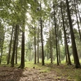
- Eilenberg windmill stump, first view of the northern Lippe mountains .
- Steinberg, NABU grounds with magnificent views in fine weather
- Wendlinghausen castle garden, the castle is privately inhabited and not accessible.
Safety guidelines
- The forest and farm roads in the northern Lippe highlands are generally very good to drive on. Damage / obstructions / road closures may occur due to seasonal weather events or forest maintenance work.
- The NRW State Forestry Act must be observed. This has been observed in the route guidance.
- The author accepts no liability for the accuracy of the tourist information / links and the GPX track.
Nearby

