From Krienseregg via Schönenboden to Fräkmüntegg on Mount Pilatus

- 2:00 h
- 4.94 km
- 397 m
- 30 m
- 1,023 m
- 1,420 m
- 397 m
- Start: Krienseregg
- Destination: Krienseregg
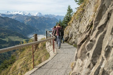
From the middle station of the Kriens panoramic gondola lift on Krienseregg, the hike climbs gently towards the south-east. After about 2.5 kilometres, you reach the cantonal border between Lucerne and Nidwalden. There, the trail turns west and climbs a little more steeply. After another 2.5 kilometres or so along the cantonal border, you reach the Fräkmüntegg mountain station, the end point of the tour.
Good to know
Best to visit
suitable
Depends on weather
Tour information
Familiy-Friendly
Stop at an Inn
Author
Luzern Tourismus
Organization
Luzern Tourismus
License (master data)
Luzern Tourismus

Nearby