Harzer BaudenSteig 2: From Lerbach to Sieber

- 6:00 h
- 19.49 km
- 689 m
- 686 m
- 266 m
- 810 m
- 544 m
- Start: Lerbach, at Hotel Sauerbrey
- Destination: Sieber
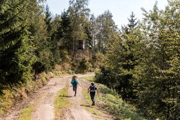
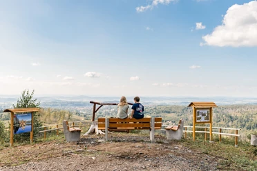
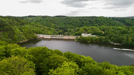
In Lerbach, now a district of Osterode, begins the 2nd stage of the BaudenSteig. Due to numerous mining sites, Lerbach was often referred to as a "mountain village" in the past, although it lies in the valley. The path leads to the idyllically located Sösestausee. Today, the Sösestausee supplies drinking water to the region around Göttingen and the area around Hanover. Shortly after the reservoir, the path rises. On the heights, on natural paths, it is excellent for hiking. Here in the "Auf dem Acker" area, already in the Harz National Park, there is a beautiful high moor landscape. The ridge consists of Acker-Bruchberg quartzite. This is a very hard rock, so the "Acker" resisted weathering far better than the surroundings and rises to over 800 meters above sea level, guaranteeing wonderful views. The Hanskühnenburg rock announces the nearby mountain hut. From the tower, you can enjoy a panoramic view in good weather. Time for a pleasurable break. By the way, one of the most prominent hikers at the Hanskühnenburg rock was Johann Wolfgang von Goethe, although back then there was no rustic mountain hut yet. The goal is near: from here the BaudenSteig leads only downhill to Sieber.
Good to know
Best to visit
Tour information
Stop at an Inn
Author
Harzer Tourismusverband
Organization
Harz: Magische Gebirgswelt
License (master data)

Nearby