


- 2:58 h
- 11.09 km
- 144 m
- 148 m
- 270 m
- 338 m
- 68 m
The "Bergische Heimatlied", which was written in Solingen at the end of the 19th century, is now regarded as the anthem of the entire region between the Rhine and Sauerland, Ruhr and Sieg. The six verses of the song accompany the hiker on the "Heimatweg" through Wipperfürth and its surroundings and bring him closer to the country, its people and Bergisch peculiarities.
How the medieval town at the ford through the Wupper came into being is just as important to discover as the traces of the numerous devastating town fires. Hikers meet Engelbert von Berg, who granted Wipperfürth its town charter at the beginning of the 13th century, and learn about the importance of water for the early economic development of the region. From the historic town center to the banks of the Wupper and up to the dam wall of the Neye reservoir, there are not only views of the Bergisch heights to discover along the 11-kilometre circular route, but also insights into other regions of the Bergisches Land. There are just as many interesting things to learn about the "Bergisch triad" of regional half-timbered construction as there are about the Lindlar quarries, the "fruit chamber" of the Bergisches Land in Leichlingen or the art of hydraulic engineering in a region "spoiled" by rainfall. The Wipperfürth "Heimatweg" also offers an overview of the thematic focuses of the other 23 STREIFZÜGE trails in the "Bergisches Wanderland".
The trail has a total of 7 information boards and 1 audio station. We would like to thank Roland Kissau, who looks after the trail as a volunteer trail patron.
Good to know
Pavements
Street
Trail
Best to visit
suitable
Depends on weather
Directions
The "Heimatweg" runs as a circular hiking trail mostly on well-surfaced farm tracks and roads. Behind the Ohl meadows, the trail leads along the Wupper on wide paths (partly paved, partly cobbled), behind Voßkuhle on field paths up to Hasselbick. From there, the trail descends to the dam wall of the Neyetalsperre reservoir. Forest paths take you through the Neye valley to the village of Klitzhaufe. After crossing the Neye, a narrow path leads uphill, continuing on dirt tracks up to Großblumberg and down to Wipperfürth. At the beginning and end of the loop, the path leads through the town.
Tour information
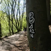
Labelling
Loop Road
Stop at an Inn
Directions & Parking facilities
Take the A4 to the Moitzfeld exit. Straight ahead through Moitzfeld, Herkenrath and Spitze to the B 506, turn right through Bechen to Wipperfürth. Turn right at the second set of traffic lights to Marktplatz;
Free parking on the Ohler Wiesen and Wupperstraße. Paid parking on the market square is limited to 2 hours.
From Cologne take the S-Bahn 11 to Bergisch Gladbach, then the 426 bus to Wipperfürth bus station.
Author
Das Bergische GmbH - Bergisches Haus
Friedrich-Ebert-Straße 75
51429 Bergisch Gladbach
Organization
Das Bergische GmbH - Bergisches Haus
License (master data)
Das Bergische GmbH - Bergisches Haus

Social Media
Nearby

