Hiking between CLOUDS and STONE - rock idyll and panoramic view

15.15 km long
Round trip
Difficulty: difficult
Condition: difficult
Great panorama
Hiking
  • 4:25 h
  • 15.15 km
  • 360 m
  • 337 m
  • 399 m
  • 588 m
  • 189 m
  • Start: Markt Wolkenstein
  • Destination: Markt Wolkenstein

Those looking for unique rock formations, magnificent views, and healing water cannot make a better choice.

This impressive circular hike starts at the historic market square of the small mining town of Wolkenstein. Not far from the imposing castle, which picturesquely rises above the Zschopau valley, it follows the long-distance hiking trail EB downstream. Finally, the path turns right into the impressive rock labyrinth of the Wolkensteiner Schweiz. Here awaits the first highlight for hikers: From the Brückenklippe – a spectacular viewing platform – there is a breathtaking view of two bridges spanning the Zschopau. The elegant stone arch bridge and the distinctive railway bridge are popular photo motifs.

Then it continues to Anton-Günther-Höhe. This idyllic rest area offers a beautiful view of the silhouette of Wolkenstein. From here, forest paths lead downhill into the traditional spa grounds of Warmbad. At the drinking pavilion, you can enjoy the soothing thermal water, while children can have fun at the nearby water playground.

Behind the spa park begins another chapter: the historic mining area. On scenic paths with sometimes quirky names like Palmbaum and Himmelreich, hikers encounter, among other things, a masonry mining shaft – a silent witness to the region’s long mining history.

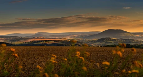
Southwards, now on the European long-distance path E3, endless wide views open up of the mountain world of the Annaberger Land. At an airy height, hikers pass again the steep banks of the Zschopau valley. The Zeisigstein, a distinctive viewpoint, is located about 100 meters above the confluence of Zschopau and Preßnitz.

A varied forest trail leads downstream, past small rock formations and always accompanied by the flow of the Zschopau in the valley. For the finale, the romantic ascent through the Wolfsschlucht awaits. A narrow path winds up through the Schlossfelsen to the starting point in Wolkenstein.

Good to know

Pavements

Street
Asphalt
Gravel
Trail
Path

Best to visit

suitable
Depends on weather

Directions

Start of the route at Markt Wolkenstein, in the Town Hall tunnel: Following the red-marked European long-distance path Eisenach-Budapest and the Zschopau valley trail initially downstream, hikers shortly before the valley floor turn right into the rock labyrinth of the Wolkensteiner Schweiz, continuing on the EB. Over the Brückenklippe viewing platform, the route goes uphill and sharply left at the forest edge. The terrain continues to rise to the Anton-Günther-Höhe, a plateau with benches and a shelter, before descending again through the forest via the Himmelsleiter and past other gneiss formations towards Warmbad. This short section is not on the EB, the paths meet again in the valley. Keep left and finally cross the road to walk on the EB into the spa park area. After the spa lake bridge in the Warmbad spa, hikers switch to the yellow marking. Left of the Warmbad, Am Kurpark bus stop, the path leads back into the green. Follow the yellow marking further and take in the information on mining history, while heaps from the mining era are repeatedly visible along the way. After crossing the B101, the field path leads to an outlook height until it meets the blue-marked E3 – keep right. At the junction of EB and E3 continue left to follow the E3. After crossing the B171, the route continues straight ahead (initially on the yellow and then at the Vorwerk Kohlau left on the green marking). At the Zeisigstein viewpoint, keep right to descend through the forest to the Zschopau valley trail. Keep right and after crossing the Eschenbach switch again to the yellow marking. Through the Wolfsschlucht, ascend right to the old town of Wolkenstein.

At the end of the hike, a visit to Wolkenstein Castle is worthwhile.

Tour information

  • Loop Road

  • Stop at an Inn

Directions & Parking facilities

via the B101 or the B171 to Wolkenstein

Parking options at/in the vicinity of the hiking route:

Parking lot residential area Warmbad

Warmbad, An der Silber-Therme

Wolkenstein, hiking parking lot - center/Annaberger Straße

Wolkenstein, Bahnhofstraße


Bus stops at/in the vicinity of the hiking route:

Gehringswalde, Drei Rosen

Warmbad, Am Kurpark

Wolkenstein, Annaberger Str

Wolkenstein, Markt

Wolkenstein, Bahnhof/B101

Train

Erzgebirgsbahn, Wolkenstein station


Additional information

Author

Anni Borrmann, TVE

Organization

Erlebnisheimat Erzgebirge

License (master data)

Anni Borrmann, TVE
License: no copyright required (Public domain) (no copyright)

Author´s Tip / Recommendation of the author

Be sure to allow enough time to enjoy the hike! A special highlight is the Wolkensteiner Zughotel with its snack bar / café, which is located close to the route.

Nearby