Hiking route 'Steinpilz' (Boletus) (Grafenau - Racheldiensthütte)

- 5:00 h
- 15.40 km
- 450 m
- 195 m
- Start: Grüber Str. 1, 94481 Grafenau
- Destination: Racheldiensthütte, St. Oswald-Riedlhütte
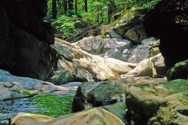
The hiking trail 'Steinpilz' (Boletus) starts in Grafenau and initially leads through the villages of Grüb and Großarmschlag to Reichenberg and into the town centre of Riedlhütte. At the outskirts of the town, the National Park begins. The Ölbach stream is crossed on short boardwalks and bridges until you reach the National Park Road, which you then cross. The path continues until you reach a forest road. In the further course, you'll pass Neuhüttenwiese until you finally arrive at the Racheldiensthütte and the adjacent Schachtenbachklause.
Good to know
Best to visit
suitable
Depends on weather
Contact person
Hans-Eisenmann-Haus
Nationalparkzentrum Lusen
Böhmstr. 35
94556 Neuschönau
Author
Nationalparkverwaltung Bayerischer Wald
Freyunger Str. 2
94481 Grafenau
Organization
Nationalparkverwaltung Bayerischer Wald
License (master data)

Nearby