Hilchenbach Höhenring


- 6:00 h
- 24.69 km
- 379 m
- 380 m
- 350 m
- 632 m
- 282 m
- Start: Historic marketplace Hilchenbach
- Destination: Historic marketplace Hilchenbach
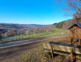
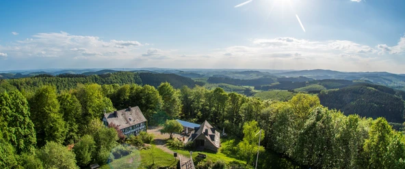
Along the entire ridgeway, the hiker is offered magnificent panoramas and rustic landscapes, complemented by beautiful resting places and refreshment options. A visit to the nearby Gillerturm (654 m above sea level) and the historic Ginsburg is always worthwhile.
The hike does not necessarily have to be planned as a day route. A variety of access paths offer the possibility to shorten the hike and return early to Hilchenbach.
Due to the beautiful route, its versatility, and the possibility of combination with the Rothaarsteig, the Sauerländischer Gebirgsverein selected the Hilchenbach Höhenring as the hiking trail of the years 2018 to 2020.
Good to know
Best to visit
Tour information
Loop Road
Loop Road
Stop at an Inn
Author
Susanne Träger
Organization
Stadt Hilchenbach
License (master data)

Nearby

Download GPX file