- Photos & Map
How would you like to arrive?
- Description
- Good to know
- Nearby
Download GPX file
- 2:15 h
- 7.44 km
- 181 m
- 181 m
- 310 m
- 398 m
- 88 m
- Start: Jocketa hiking car park
- Destination: Jocketa
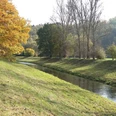
The starting point is the Jocketa hiking car park. You start towards the monumental Elstertal bridge, which you cross before descending into the Elstertal. You then follow the Elster until you pass the Devil's Pulpit.
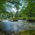
There are two options for the further route: either continue along the White Elster on the direct route to the "Lochbauer" to reach the Schäfer bridge. You use this to cross the White Elster.
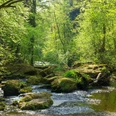
Alternatively, at the Devil's Pulpit you can turn right into the Nymph Valley to reach the inn "Pfaffenmühle", then the Vogtland Environmental and Nature Conservation Center Pfaffengut and continue via Pfaffengutstraße to the "Lochbauer".
After crossing the White Elster, continuing along the path, you will see the Königshügel on the left. Further north on the route, Eisenberg with the 14m-high Julius Mosen tower offers a magnificent view of the Pöhl reservoir. Then it continues over the Pyramid Meadow back to the starting point.
Note: Impairment of hiking trails around the Elstertal bridge and Barthmühle
Please inform yourself about possible impairments or alternative routes before your hike.
Good to know
Best to visit
Directions
Jocketa hiking car park – Elstertal bridge (via bridge central walkway) – descent into the Elstertal – Devil's Pulpit – (Alternative: through the Nymph valley – inn "Pfaffenmühle" – Vogtland Environmental and Nature Conservation Center Pfaffengut (with wildcat enclosure) – (detour to Falconry Herrmann in Plauen possible)) – otherwise continue along the White Elster – Restaurant "Lochbauer" – Schäfer bridge over the White Elster – Gunzenberg sewage treatment plant – Königshügel (viewpoint) – south slope of Eisenberg – turnoff to the ship landing stage – ascent to the Julius Mosen tower on Eisenberg – descent to Huthausplatz – Friedenshöhe – Triebtal – Pyramid Meadow – Pyramid bridge – Jocketa hiking car park
Tour information
Loop Road
Stop at an Inn
Directions & Parking facilities
Take the Vogtlandbahn either on the Weischlitz/Plauen-Gera route to Barthmühle or on the Plauen-Zwickau route to Jocketa.
Information about travel by bus and train is available from the Vogtland Tourism and Transport Center at www.vogtlandauskunft.de as well as by phone at 03744 19449.
Additional information
Tourist information at Gunzenberg campsite
Tel. 037439 45050
www.talsperre-poehl.de
Catering options
Restaurant "Lochbauer"
Tel. 03741 526641
www.lochbauer.de
Inn "Pfaffenmühle"
Tel. 03741 525772
www.pfaffenmuehle.de
Leisure facilities
Vogtland Environmental and Nature Conservation Center Pfaffengut
Tel. 03741 522897
www.pfaffengutplauen.de
Falconry Herrmann
Mobile tel. 0174 9147124
www.falknerei-herrmann.de
Author
Tourismus Marketing Gesellschaft Sachsen mbH
Organization
Vogtland - Sinfonie der Natur
License (master data)
Vogtland - Sinfonie der Natur
Author´s Tip / Recommendation of the author
Try the homemade cakes in the inn "Pfaffenmühle" and then continue your hike revitalized.
Safety guidelines
not barrier-free or pram-friendly - stair descents into the Elstertal and Triebtal
Nearby
