ElsterWasserWeg - Elster Hiking Trail


- 3:45 h
- 11.34 km
- 265 m
- 265 m
- 306 m
- 404 m
- 98 m
- Start: Parking lot on Pfaffengutstraße, opposite Waldhaus Reißig
- Destination: Parking lot on Pfaffengutstraße, opposite Waldhaus Reißig
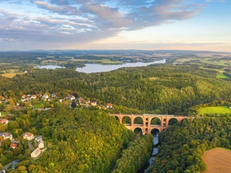
The ElsterWasserWeg leads between the model city Plauen and the Pöhl Reservoir over about 11 kilometers through unique landscapes. Highlights such as the Elstertal Bridge - the second-largest brick bridge in the world, eastern Germany's largest falconry Hermann, the Vogtland Sea Pöhl Reservoir, and the impressive Trieb Valley nature reserve offer variety and deceleration at the same time.
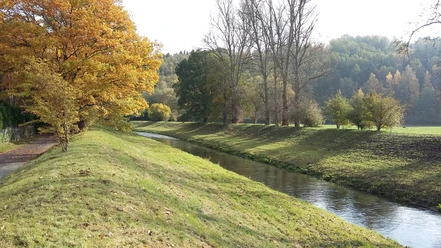
The connecting element water, with all its facets, with the White Elster, the Pöhl Reservoir, the Trieb, and the Kaltenbach in Nymphental, is an impressive and varied experience along the hiking trail.
Please note: The Elstertal Bridge is expected to be inaccessible due to construction work until mid-2026.
Waypoints


Good to know
Pavements
- Unknown (74%)Trail (15%)Path (11%)
Best to visit
- suitableDepends on weather
Tour information
Cultural Interesting
Loop Road
Loop Road
Stop at an Inn
Author
Anika Seidel
Organization
Vogtland - Sinfonie der Natur
License (master data)
Anika Seidel

Nearby


Download GPX file