MTB route Lückendorf-Weißbachtal-Kristina Lake


- 3:15 h
- 33.89 km
- 594 m
- 593 m
- 233 m
- 535 m
- 302 m
- Start: Netto South
- Destination: Netto South
Into the Zittau Mountains and on to our neighbors in the Czech Republic. This up-and-down route rewards you again and again with great views and small descents. A highlight for those who like it a bit more technical is the last descent below Schwarzer Berg. Afterwards, it continues quite leisurely on forest and meadow paths to Kristina Lake.
Good to know
Best to visit
Directions
The start is at Zittau-South. Meeting point: Netto parking lot or nearby. This route starts easy. You ride a section through the town before heading along the Neisse Cycle Path towards the tri-border area of Poland-Germany-Czech Republic. Then you reach Hartau – alternatively, you can also start your MTB route here (waypoint: parking lot at the border). You cycle south and pass the water catchment area for Zittau: On the left, you see the well house and some wells, five of them on the Czech side. These have been supplying the Zittau drinking water network for several hundred years. Now, you turn right onto the Pine Valley Path towards Mühlsteinberg. A small singletrail leads you to Lückendorf Street. Above the Mühlstein table – a rest area with a round stone bench and table – you cross Lückendorf Street. The new Heideberg Path takes you to the Mühlsteinberg summit. If you feel like it, you can veer ten meters to the left from the path at the highest point. From here, you have a beautiful view of Jeschken and the Weißbach Valley, which you will cycle through later. In the first meters of the descent, the panorama with the high forest is an unforgettable sight for every biker.
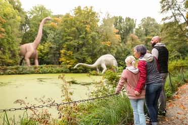
A short, pleasant stretch of forest road follows and you reach another descent that takes you to Lückendorf with its "Gasthaus zur Schmiede". It goes slightly uphill as you continue through the village. Here you have a nice panoramic view, pass under a ski lift, and ride along the west side of Sommerberg. You reach the forest edge and briefly descend. Then follows a steep climb. Here you really have to pump. If thirst overcomes you in between, you can take a break and get off your bike. Halfway up the hill, you find a spring – the Scheibeborn. Now you get onto Ringelshainer Path that leads you to the Löwenbuche. If you want to learn more about it, you’ll find interesting information including a map here. Behind the barrier, you are again with the Czech neighbors but continue towards Zittau Street. The old trade route is now a modernized forest road – a pleasant descent in between. On the left lies Fuchsberg (535 meters). After a sharp left turn, there is a really beautiful view into the Bohemian region with its volcanic mountains. The next section of the MTB route on Finkenbrunner Path is a challenge for race bikers – big chainring and smallest sprocket is now the way to go. But don’t overdo it: even in this very quiet area, you may still meet someone coming towards you. At some point the fun ends, and you head uphill on a forest road. Midway, you pass a bunker of the former border fortifications built around 1933 on the right. At Bäcker Cross (left on the tree) on the saddle of Rollberg, you can catch your breath. Now follows a technically quite demanding (S1) section with some difficult passages and singletrails that are changing annually due to erosion. Alternatively, you can stay left on the forest road and at the next opportunity turn right twice. Both paths lead you to Kaisergrund, a valley with sandstone rocks and many climbing targets. Hidden behind pines and spruces lurk some rocks that are difficult to climb. But soon you come out of the forest and see the village Dolní Sedlo (Spittelgrund). The next goal is in the valley: Hradec (Grottau). For this, you enter the forest once again. It’s really fun to ride full speed down the serpentine to Zigeunerwinkel and continue towards Hradec. On a detour to Kristina Lake, a recreational area, there are a lot of restaurants. Now it goes to the Polish border on a straight road (1500 meters) with a cycle path. You quickly return to the start.
Tour information
Loop Road
Stop at an Inn
Equipment
Directions & Parking facilities
Motorway A4 Dresden towards Görlitz
A 4 exit 91 "Weissenberg"
At the intersection turn right (direction Löbau/Zittau)
After approx. 2 km turn right (direction Löbau/Zittau)
After approx. 3 km turn left (direction Löbau/Zittau), after 100 m immediately left again (direction Löbau/Zittau)
After approx. 6 km you reach the upgraded section B178n (three- or four-lane) and drive it for 26 km until the end
Turn left (NOT RIGHT TOWARDS ZITTAU), drive to Oderwitz
Turn left onto B 96, 7.5 km to Zittau
About 400 m after crossing a bridge, turn right (signposted "Olbersdorfer See FREIZEIT-OASE")
Turn right again after 100 m and drive to the roundabout
At the roundabout take the 3rd exit (campsite sign)
400 m more to the parking lot
You are also welcome to use public transport for your journey. For this, you will find information on the ZVON page under timetable information.
Stop "Südstraße" line 2 or 3
Additional information
Further information and literature at the tourist information in Zittau.
Author
Tourismuszentrum Naturpark Zittauer Gebirge
Organization
Das Landschaftswunderland Oberlausitz
License (master data)
Tourismuszentrum Naturpark Zittauer Gebirge

Author´s Tip / Recommendation of the author
Safety guidelines
Suitable for MTB
Nearby
Download GPX file