- 3:00 h
- 10.50 km
- 110 m
- 110 m
- Start: Münsterstraße
- Destination: Münsterstraße
In April and May, countless plum trees illuminate the surroundings around Oelde-Stromberg with their blossoms. But also in the other months, the approx. 11 km long hike offers great views over the Münsterland. 9 information boards along the route provide information about the special features of the "Stromberger Plum".
Good to know
Directions
The trail starts at the "Alte Vikarie", Stromberg's home town, in the middle of the small town centre. After a few steps, the landscape opens up to reveal the first plum orchards. In the hilly terrain, the hiking route dips into a small wooded area after the Meierhof Limberg farm and soon reaches the Stemich plum farm.
Accompanied by countless plum trees, the hike repeatedly offers magnificent views over the expansive landscape. The panorama is particularly beautiful at the viewing platform, which also provides a nice opportunity for a well-earned rest.
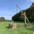
Once again, past the Lamberti Church, the trail descends in a wide arc and climbs up through plum orchards to the Stromberg castle ruins. Here, at the latest, hikers should also try the delicious Stromberg plum.
Tour information
Loop Road
Nature Highlight
Directions & Parking facilities
Oelde railway station is about 6 km from the starting point of the hike. Bus line 474 connects the station with the district of Stromberg. The journey takes about 10 minutes.
By car, take the A2 motorway (Oberhausen-Hannover). From the Oelde exit, turn right in the direction of Stromberg. After 2.7 km turn left onto Beckumer Straße and follow the road to the centre of the village.
Free parking is available in the Stromberg in the Gaßbachtal.
Additional information
Diese Tour bei Komoot: https://www.komoot.de/tour/397868131
License (master data)
Münsterland e.V.

Nearby