- Photos & Map
How would you like to arrive?
- Description
- Good to know
- Nearby
Download GPX file
- 3:55 h
- 16.30 km
- 15 m
- 18 m
- 133 m
- 151 m
- 18 m
- Start: Pilgrimage Church Rosenthal, Am Marienbrunnen 9, 01920 Ralbitz-Rosenthal, OT Rosenthal
- Destination: Pilgrimage Church Rosenthal, Am Marienbrunnen 9, 01920 Ralbitz-Rosenthal, OT Rosenthal
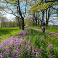
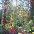
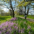
A pleasant flatland walk through long pine forests and along well-traversable field paths amidst the Sorbian settlement area
The bilingual municipality of Ralbitz-Rosenthal is located in the core area of the Sorbian-speaking Lusatia. Many Sorbian traditions and customs are still lovingly maintained in these villages.
In Rosenthal, there is a Marian pilgrimage site which was managed by Cistercians until 2007. Several pilgrimages take place annually on the pilgrimage meadow, including that of the Diocese of Dresden-Meissen. The pilgrimage site of Rosenthal is one of the five pilgrimage sites united since 2000 in the association "Central European Pilgrimage Sites".
The municipality recommends 5 flatland walking routes through its local forests and floodplains; across meadows and fields. This route is the longest and is also suitable as a cycling route (bike needs to be pushed only on a short forest section due to rough unevenness).
Good to know
Pavements
Best to visit
Directions
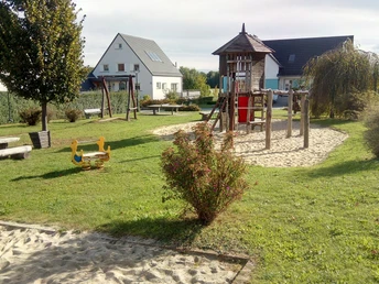
- The route starts in Rosenthal and leads past the bakery Scholze via Romuald-Domaschke-Straße and the playground, then turns left onto Siedlungsweg.
- At the end of Siedlungsweg, turn right onto the field path.
- After 250 meters, keep left at the fork towards Naußlitz. (Do not take the first left turn which appears after 220 meters).
- After another 250 meters, there is a small rest area in the forest.
- Then turn left at the crossroads onto the KRABAT cycling route/Sorbische Impressionen cycling route.
- Follow the cycle path for approx. 1 km and at the signpost to Ralbitz, turn right over the small metal bridge (follow the "Red Dot" marking).
- Behind the bridge, there is again a covered rest area.
- Via a small path, you pass a small chapel up to a large wooden prayer cross (on the right). From there, the path widens again.
- After approx. 250 meters, turn right and head directly towards the Ralbitz cemetery.
- Just before the cemetery, there is a cozy rest area on Lasker Weg.
- In Ralbitz, you have the opportunity to visit the listed cemetery, shop at the local bakery, or have a snack at Marion's Kegeltreff (Scholze's snack bar).
- At the end of Lasker Weg, turn right onto Hauptstraße, then at the large wooden cross (80 meters) immediately turn left onto Seidau and after approx. 40 meters, turn right again onto Schulstraße.
- At the end of Schulstraße, turn left and stay on Truppener Straße, which becomes a field path and finally leads into the forest.
- At the beginning of the forest, go straight ahead, do not turn right.
- After approx. 600 meters, the path forks. Turn right here.
- After 650 meters, the path crosses the "Alte Straße" and you now turn left onto this historic street (forest path).
- After approx. 1 km, you reach a forest path junction and could shorten the route to Cunnewitz here by turning left.
- However, the main route continues straight ahead on the "Alte Straße" (after 20 meters, the path continues diagonally right).
- After approx. 1 km, you reach a shelter and the "Gypsy Fountain," which is explained with an information board.
- However, continue for another 200 meters on the path before turning left.
- For the next 600 meters, follow a very natural path (cyclists are advised to walk this section due to numerous uneven spots).
- You then reach a wider field path again and turn left.
- Follow the path for approx. 600 meters and then turn right.
- You now arrive in Cunnewitz and turn left onto Osterreiterweg towards the village center.
- At the chapel, there is another small rest area before you follow the signs to Schönau (turn right onto Dorfstraße).
- On the left side of Dorfstraße in Cunnewitz, you can purchase honey and honey products at Bienenhof Regina.
- At the outskirts of Cunnewitz, you cross the "Klosterwasser" and after a few meters arrive in Schönau. Dorfstraße becomes Reichenstraße.
- At the next intersection, turn left onto Wittichenauer Straße.
- After 150 meters, turn onto "Dr.-Georg-Möller-Straße," which is also marked with the Frog cycling route.
- For children, a public playground a few meters further offers a welcome rest spot.
- Follow the Frog cycling route signs along the field and forest path to the next major road just before Laske (approx. 2 km). (There is another shelter on this section.)
- At the road, turn right, leaving the Frog cycling route which continues left.
- After 150 meters, turn left onto the bike and footpath (approx. 900 meters) which leads back to Rosenthal. There is another rest area after a few meters on this paved path.
- At the end of the paved path, turn left and arrive in Rosenthal.
- Follow the main street "Am Marienbrunnen." This brings you to your starting point of the route where you can visit the pilgrimage church and the Marian spring.
Tour information
Cultural Interesting
Loop Road
Tour with Dog
Equipment
Sturdy footwear
Weather-appropriate clothing
Binoculars
Provisions
Mosquito spray
Overview map
Mobile phone with power bank
First aid kit
Mushroom basket in autumn
Directions & Parking facilities
- Autobahn A4 (between Bautzen and Dresden)
- Exit Uhyst am Taucher
- Turn towards Kamenz
- Stay on S101 for approx. 9 km
- Turn onto S97 (Kamenzer Straße) after Zerna
- The next town is Rosenthal
- Turn into the town at the 2nd opportunity (Am Marienbrunnen)
- The destination (pilgrimage church) is on the left (after 300 m)
Please use the digital and thus current timetable information of the Zweckverband Verkehrsverbund Oberlausitz-Niederschlesien (ZVON): www.zvon.de
Additional information
Points of Interest:
- Listed cemetery in Ralbitz
- Gypsy Fountain
- Pilgrimage Church and Marian Spring in Rosenthal
- Bienenhof Regina in Cunnewitz
Supply Options:
- Land bakery Maik Scholze in Rosenthal
- Steam bakery Roman Scholze in Ralbitz
- Scholze's snack bar Ralbitz
Further links and info:
- Upper Lusatia: www.oberlausitz.com
- Upper Lusatian Heath and Pond Landscape: www.oberlausitz-heide.de
- Municipality Ralbitz-Rosenthal: www.ralbitz-rosenthal.de
- Tourism page about the Sorbs: www.tourismus-sorben.com
- Digital German/Sorbian dictionary: www.soblex.de
Literature
Link to the online shop of the "Domowina-Verlag" Bautzen
Author
OHTL e.V.
Organization
Das Landschaftswunderland Oberlausitz
License (master data)
Author´s Tip / Recommendation of the author
Due to patchy network coverage, it is recommended to download the route before starting.
Unfortunately, there are hardly any places to eat, so we recommend this route as a picnic route.
Safety guidelines
Entering the forests is at your own risk - however, it is strongly advised against during strong winds and storms or snow and ice.
Hiking with caution - Brochure from the German Hiking Association with tips for proper behavior when hiking around (wild) animals.
Map
- SACHSEN KARTOGRAPHIE GmbH Dresden: Leisure map "Upper Lusatia"
- SACHSEN KARTOGRAPHIE GmbH Dresden: Cycle and hiking map "Upper Lusatian Heath and Pond Landscape" (Sheet 1 and/or Sheet 2)
Both maps are also available in the online shop of the Marketinggesellschaft Oberlausitz-Neiderschlesien mbH.
Nearby


