Siebengebirge - Geo hike: Einsiedlertal


- 2:15 h
- 7.24 km
- 246 m
- 246 m
- 129 m
- 363 m
- 234 m
- Start: Hiking car park in Schmelztal at the entrance to Einsiedlertal (recommended hiking counterclockwise)
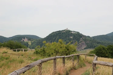
In earlier centuries, since 1753 in Bad Honnef, ores were mined in open-pit mining in the Siebengebirge. Mines and shafts several meters deep were dug. Later, shafts were dug that led vertically into the earth and were accessed by ladders. Branching off from these shafts were galleries underground that required drainage and ventilation. Copper, lead, zinc, and iron ores were mined in the Siebengebirge, with over 70 ore mines detectable in Bad Honnef alone. Mining locations were Einsiedlertal, Schmelztal, Brüngsberg, and near the Servatius chapel. Iron wedges were used to drive cracks into the walls and broke the ores, which were then transported to the surface with wheelbarrows or small transport carts. The ore chunks were separated from impurities in settler washes and crushed by hand in stamp mills to reach the ore-bearing rock. The mine in Einsiedlertal, first called "St. Theresia" and later "Glückliche Elise," operated from 1753 to 1815 and from 1847 to 1868. Ores were extracted in several galleries up to 38 meters deep, crushed in a stamp mill, and processed on site using a metal smelting hut.
Good to know
Best to visit
Tour information
Cultural Interesting
Loop Road
Loop Road
Stop at an Inn
Author
Tourismus Siebengebirge GmbH
Organization
Rhein-Sieg Tourismus
License (master data)

Nearby


Download GPX file