To the Wendelstein via the König-Maximilian-Weg


- 6:15 h
- 12.17 km
- 1,012 m
- 1,012 m
- 799 m
- 1,811 m
- 1,012 m
- Start: Bayrischzell town center
- Destination: Bayrischzell town center
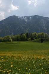
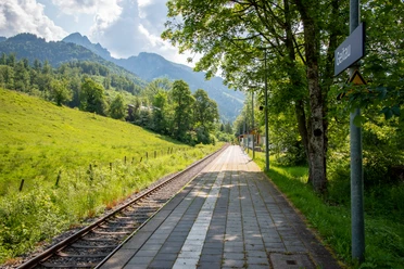
On foot to the landmark of Bayrischzell, the Wendelstein. This scenic route with a high proportion of narrow paths can be planned as a full-day outing. The ascent is crowned by the circumnavigation of the summit massif. The descent is also gentle on the knees by using the cable car.
Good to know
Best to visit
- suitableDepends on weather
Tour information
Loop Road
Loop Road
Stop at an Inn
Summit
Author
Regionalentwicklung Oberland
Organization
Alpenregion Tegernsee Schliersee
License (master data)

Nearby

Download GPX file