- 8:30 h
- 27.10 km
- 1,022 m
- 1,022 m
- 278 m
- 515 m
- 237 m
- Start: Kurhaus Manderscheid, 54531 Manderscheid
- Destination: Kurhaus Manderscheid, 54531 Manderscheid
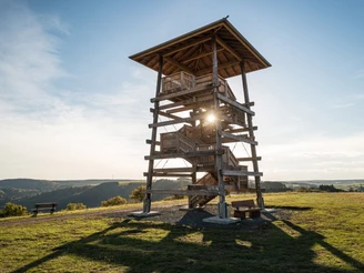
“Wander through” millions of years of history in a single day along the 26-kilometre VulkaMaar Trail around Manderscheid. Over the first few kilometres, the trail follows the Eifelsteig route. The small river Lieser accompanies you down in the valley. Later, the trail crosses the Kleine Kyll on a wooden bridge, before a very narrow path ascends up to the Wolfsschlucht ravine over large rocks, some of which are slippery. The VulkaMaar Trail continues towards the Windsborn hill crater lake, the only crater lake north of the Alps. It is part of the group of volcanoes of the 517-metre high Mosenberg hill. The route soon passes through the small town of Meerfeld before continuing uphill. At the next place offering an opportunity to rest, you can enjoy the wonderful view onto Meerfeld and the maar of the same name from the “Landesblick” viewing tower. Up and downhill, following narrow paths and with a final look out onto the Manderscheid castles, the start and finishing point of this nine-hour hike is reached at Manderscheid.
Nearby


