


- 1:10 h
- 4.16 km
- 105 m
- 105 m
- 333 m
- 429 m
- 96 m
- Start: Köterberg
- Destination: Köterberg
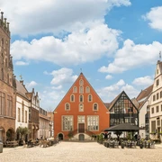
This circular trail leads around the village of Köterberg for around 4 km and offers wonderful views time and again, including of Falkenhagen Monastery. The monastery is historically closely linked to the village of Köterberg. As a result of the Everstein feud of 1407, both the monastery and the surrounding villages were destroyed. After the reconstruction by the Order of the Crusaders, the monks recruited settlers to revive the deserted villages, including the village of Köterberg. Even today, two wayside crosses here bear witness to the special relationship with the former monastery.highlights of the hike are the fantastic views, including over the village, the Ottenstein plateau and the Weser valley with the Voglerkamm ridge. Mysterious and enchanted, the trail also leads through a gorge in the forest.
More tours around the Köterberg:

Good to know
Pavements
Best to visit
Directions
From the parking lot in the village, we follow the asphalt path (Biesterfeldweg, hash mark 6) in a southerly direction, past the old belfry with the mysterious inscription. Behind the large marl hollow (Rote Wand), we turn left onto the summit path and continue to the next junction, which leads left onto Dingelstedtpfad A1. The path soon runs along the edge of the forest with wonderful views over the village, the Ottenstein plateau and the Weser valley with the Voglerkamm ridge.
When we enter the forest again, the trail descends a little to the left and then immediately turns right again towards Köterbergstraße. We cross the road and follow the wide forest path at the edge of the forest on the opposite side of the road. At the next junction, we keep sharp left and soon leave the forest. Through the meadow landscape we come to the path that leads down towards Hummersen (X18/19). Follow it to the edge of the forest. A small stone path on the left leads us onto a path into the forest. Through a picturesque gorge with a bridge over a spring stream, we head out again towards Köterbergstraße, which we cross and follow the forest edge path. At the next opportunity, we take the path on the left, which winds uphill with beautiful views. At a crossroads, we head straight on again towards the village past the Köterberg wind turbines. A hiking lounger on the side of the path invites you to take a short break with views of the Weser valley. We reach the village, where two large wayside crosses (on Köterbergstraße and Nieser Straße) indicate the denominational affiliation of the inhabitants. At the crossroads, we cross Nieser Straße diagonally to the right, past the small village community center and take the side street to the Glockenstuhl. We return to our starting point on the left.
Tour information
Loop Road
Stop at an Inn
Directions & Parking facilities
Journey from Lügde (city center):
- Leave the town in a southerly direction on the L614
- After approx. 1.5 km, leave the L614 and follow the L946 for approx. 11 km
- Turn right onto the K69 and follow this for approx. 3 km
You can find information on possible bus connections here.
More information
Contact person
Author
Organization
License (master data)

Author´s Tip / Recommendation of the author
Map
- Hiking map "Lippischer Südosten"; 6,95 €
- Hiking map "Treasure map"
- Hiking map "Hiking area Köterberg"
The above maps are available from the Lügde Tourist Information Office.
Nearby

