Access route to the Rothaarsteig from Erndtebrück

- 2:00 h
- 7.66 km
- 182 m
- 128 m
- 476 m
- 635 m
- 159 m
- Start: Center of Erndtebrück
- Destination: Rothaarsteig
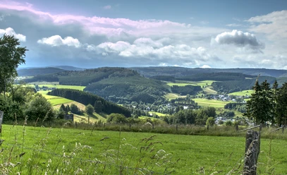
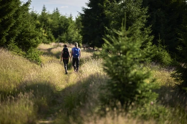
We start the hike in the center of Erndtebrück, passing the Protestant church and a playground, then turn onto the section of the Ederhöhenweg. Here, the trail goes over meadows and through forested areas past the elevations Gickelsberg, Seebach, and Ahornsberg, offering splendid views of the nature reserve and the Eder valley. Later, the route follows the meandering river area of the Eder until we reach the Rothaarsteig.

Good to know
Best to visit
suitable
Depends on weather
Tour information
Stop at an Inn
Author
Nathalie Treude
Organization
Touristikverband Siegen-Wittgenstein e.V.
License (master data)

Nearby